• General

• General
We read it, see it, and hear it: industry segments are being stressed financially and forced into reorganization, while still having to maintain service levels and duties. More recent events, like a pandemic, weather phenomena, geo-politics, and demand drop-off, have increased these pressures.
Specific to the oil and gas industry, slowly evolving energy change has affected the bottom line. Just in the past few weeks I have spoken personally with multiple individuals describing layoffs of whole divisions, while still striving to meet advanced environmental commitments that exceed regulations. These same folks take pride in maintaining some of the most impressive safety records of any industry.

Satelytics' timely responses to threats our customers face.
Satelytics exists to provide accurate and clear assessments of conditions outside of the normal operating integrity window. From ONE set of data multiple business challenges can be addressed simultaneously by any number of users, the most efficient way to invest in technology. With unmatched detail, accuracy, and speed, our geospatial analytics are unmatched in the industry — with answers rendered simultaneously via browser, smartphone, and tablet, respective to each business interest. Satelytics responds to threats in the “here and now” across our customers' geographically diverse asset areas to minimize consequence. Adoption is simple, with the outcome impactful and proven, directing efficient allocation of human and financial resources, high on the priority list of any corporation.
Our Constant Vigilance™ artificial intelligence-driven algorithms detect and, in many instances, quantify constituents in parts per million (PPM) to parts per trillion (PPT) concentrations.
Our Customers and Their Markets
Oil & Gas/Pipeline
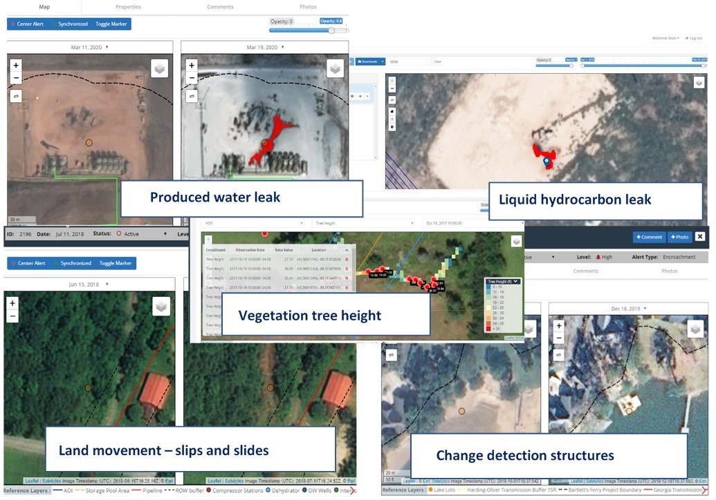
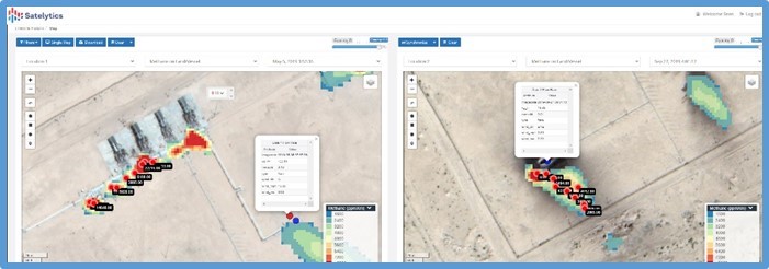
Is your company committed to reducing greenhouse gas emissions? Try our methane tool that identifies point sources of methane releases down to 250 ppm•x•m and leak rates down to 9 kg/hr. Audit compressor stations, flares, pipelines, and facilities without sending personnel out into the field. Satelytics does the heavy lifting over vast geographies — while still maintaining the accuracy of IR cameras or drone teams — minimizing human risk! In this same vein, our Constant Vigilance™ algorithms pinpoint hydrocarbon and produced water signatures with unmatched accuracy, again, reducing the human element and risk of monitoring.

Satelytics detects and quantifies methane down to 10 PPM and kg/hr leak rates.
Water/Wastewater
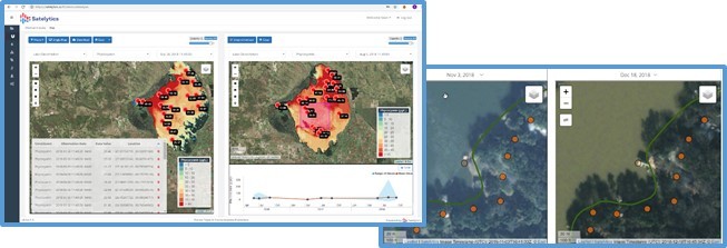
Is watershed management your task? Satelytics’ tools for the water industry include passive measurement of nutrient load (PPB) in reservoirs, tributaries, and marshland. From one set of data, monitor for shoreline erosions, vegetation health, illegal docks, and subaquatic vegetation. Reduce risk through comprehensive understanding of the mechanisms at work in your environment.

Watershed management analysis — every pixel, every time.
Power Utilities
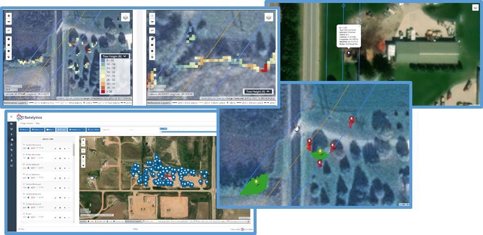
Satelytics’ algorithms power passive inspection of ROWs, including encroachments and vegetation management programs for our utility customers. Measurements like tree height, canopy encroachment, tree speciation, and vegetation density direct response personnel to the threat. Or perhaps a remediation site has re-vegetation metrics that are tied to a bond. Land classifications and monitoring of high consequence areas are also projects that can be set up in short order for your company. Satelytics’ customers also use our geospatial analytics to assign personnel and build rapid response plans after natural disasters.

Examples of tree height, vegetation growth/decline, and encroachments in infrastructure areas.
Our methane detection and quantification algorithm has also been of interest recently, as utilities look to address seasonal leakage tied to thermal expansions and contraction from gas meter sets.
Mining
A new market for Satelytics is mining, which of course shares similarities with our traditional customers: large physical asset areas and sensitive environments. Our significant experience in dust characterization and the measurement of heavy metals has led into other areas where we are developing tools to identify acid mine drainage, waste rock dumps, tailings minerology, and dam integrity for impoundments. These mining capabilities are aimed to help identify CO2 sinks and remediation areas, and — with any type of mining operation — the remoteness of the operation makes passive measurements particularly attractive.

Measurement of heavy metals in PPB concentration, acid mine drainage.
Satelytics’ technology provides constant monitoring across large geographies, akin to preventative care. Many of our customers are in discussion with their risk groups and insurers to see how premiums can be reduced with preparedness and prevention. This could mean offsetting the cost of Satelytics' implementation and adoption with lowered insurance premiums, a “dollar-swap” with tools for multiple business groups from one set of data.
Satelytics Inc., www.satelytics.com, is a cloud-based geospatial analytics software suite. Multispectral and hyperspectral imagery is gathered from satellites, UAV, planes, and fixed cameras, and processed to provide both alerts and qualitative results for our customers. Data can be gathered up to a daily basis, and results are sent to customers within hours. This includes the specific problem, location, magnitude, and even qualitative information, which minimizes cost, impact, and operational disruption for our clients.
Toledo, OH – November 13, 2020. For more information, contact David Dunham, ddunham@satelytics.com, (o) (419) 728 0060 extension #101, (c) (701) 213 0294.