• Oil & Gas,Electric & Gas Utilities,Water & Wastewater,Pipeline Operators

• Oil & Gas,Electric & Gas Utilities,Water & Wastewater,Pipeline Operators
Underground, overhead, underwater…utility infrastructure exists in the areas we live and it exists safely with designated right-of-ways (ROWs), or easements, where clearance can be maintained. When human activities like construction, digging, and vehicle movement threatens within the ROW, it is termed an encroachment. Encroachments can also be natural occurrences with vegetation growth, land movements, flooding, and wildfires — anything impinging on a protected zone around facilities, pipelines, and electric cables. Satelytics’ Constant Vigilance™ algorithms spot encroachments of all types with specificity, up to a daily basis, and alert response teams quickly that a risk exists.
Illegal activities in the ROW are a big problem — with excavation-related damages having been estimated to exceed $30B in 2019 alone. This is an increase from 2018, even with the tremendous success of one-call programs. Traditional surveillance programs have utilized aircraft and vehicle inspections with low frequencies. This past summer, my kids and I ran out of the house to watch the helicopter that was flying over our alley at low altitude looking for vegetation infringement in the wiring zone and recording conditions of infrastructure. Before that, I cannot recall the last time we had an aircraft inspecting the neighborhood — perhaps highlighting the time window that exists for damages to occur. On the topic of manned flights, I recently spoke with a vegetation manager at a utility who said that their linemen draw straws to be the “lucky” one to ride along in the inspection helicopter 150 feet off the ground during their annual flyovers!
Satelytics’ customers are often initially drawn to us because we can detect and quantify natural gas leaks and identify crude oil and produced water leaks above and below grade. As the conversation evolves, they are often surprised to hear that we also perform the more mundane activities like monitoring encroachments or vegetation management from the same data set, at the same time. We run our standard set of algorithms on almost all data we analyze. These results can feed multiple business units — leak detection, damage prevention, vegetation, construction, maintenance, engineering, and even risk insurance.
Data can be obtained from any source — drone, fixed-wing, satellite, camera, stratospheric balloon, or any other — to leverage the best possible data. We can run the analytics on data from your drone program. Or, if satellite imagery makes more sense, we can source the provider and work with you on the frequency that makes sense for your assets and budget. You benefit by sharing costs with other business units who also need results from the suite of algorithms we engage.
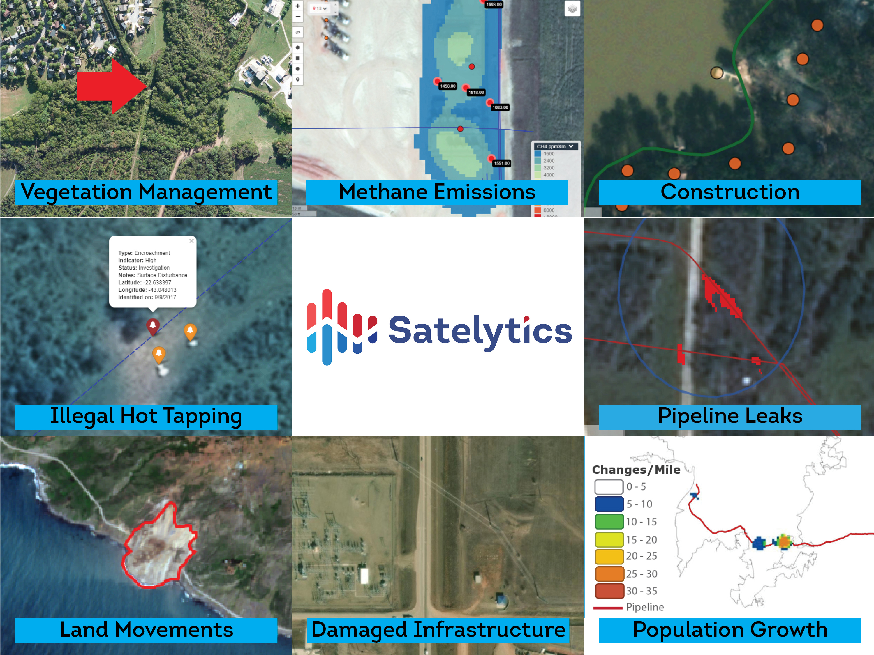
We source the highest resolution imagery (down to 30 cm pixel size) over the entire AOI to identify even the smallest threats. Gone are the days where “grainy” imagery is viewed with human eyes and comparison made to an image weeks or months old. Our analytics look in the infrared spectrum over every pixel, every time, alerting to the following and more:

A sampling of alerts provided by Satelytics.
Build your monitoring program on a regular frequency or perhaps in response to a natural disaster. Satelytics has extensive experience working in response to wildfires, hurricanes, floods, and droughts — on location, throughout the world. We have analyzed trillions of pixels with our algorithms to ensure accuracy and a robust platform.
What keeps you up at night? Satelytics can reduce risk and keep people safe while saving your company money.

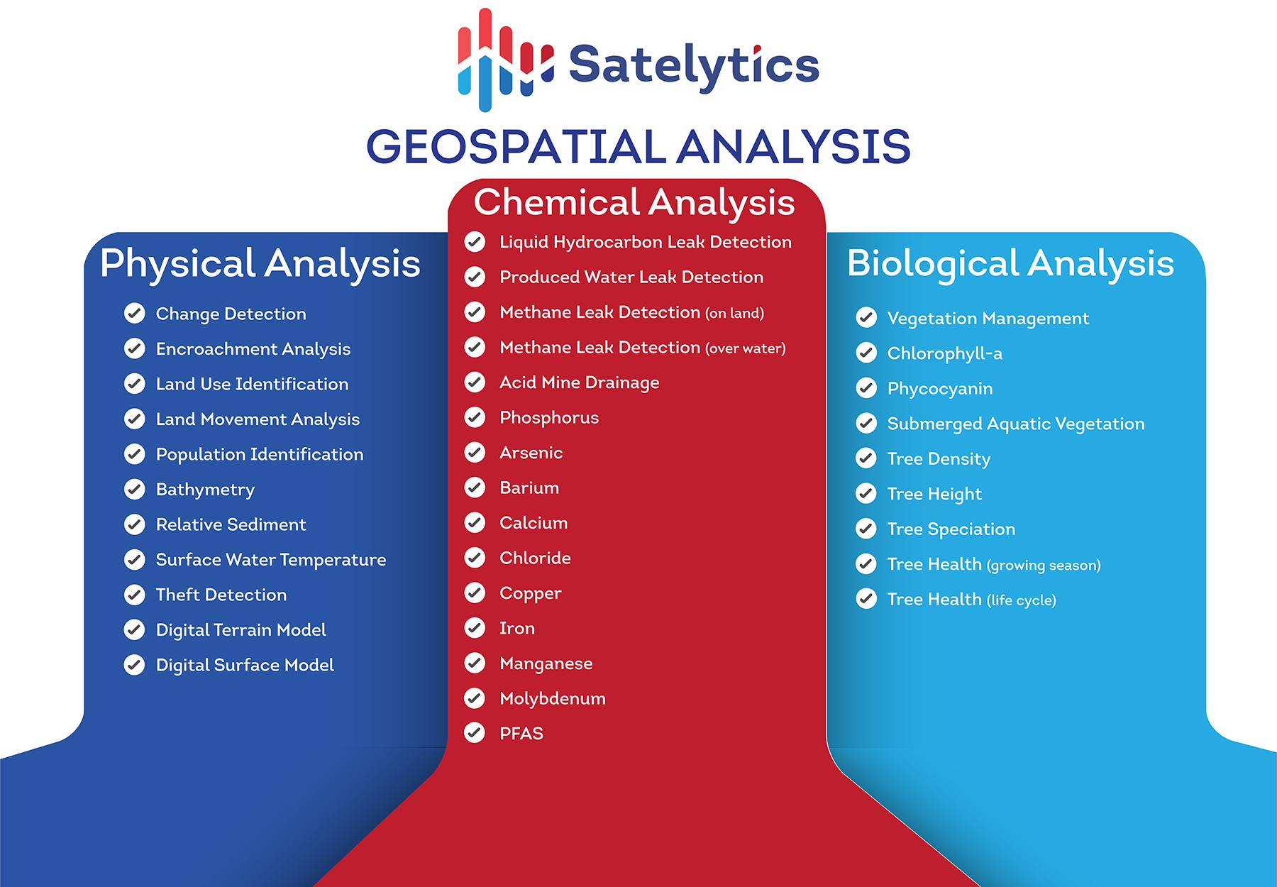
30+ algorithms to address your toughest challenges