• Oil & Gas,Electric & Gas Utilities,Pipeline Operators

• Oil & Gas,Electric & Gas Utilities,Pipeline Operators
When I present Satelytics’ methane measurement capability, the first questions asked of me center on the technology itself — accuracy, frequency, measurements, etc. I am also asked how Satelytics differs from other methods — What infrastructure can be surveyed? How quickly? What’s the cost? Let’s look at these questions and feedback we’ve received from our customers.

Methane emissions measurement options today include handheld instruments, vehicles, UAVs, aircraft, and satellite platforms. What sets Satelytics apart is the ability to monitor large areas in a matter of hours, not days or months, like other methods. Many customers report to us that a vehicle-based monitoring program can take months to survey a distribution area.
Several methane detection platforms have physical limitations that impede detection and revisit rates. Vehicle sensors are restricted by road access. Handheld sensors are even less far-reaching but also hampered by access to private property. One customer reported to us that he had to deal with dogs biting his contractors! For UAS and aircraft leak detection methods, there is often a delay in simply uploading the data for analysis.
In contrast, satellites can scan regionally in minutes and stream the data to the cloud in minutes. Satelytics’ cloud-based AI then transforms data into actionable results, delivered to field teams in a few hours.

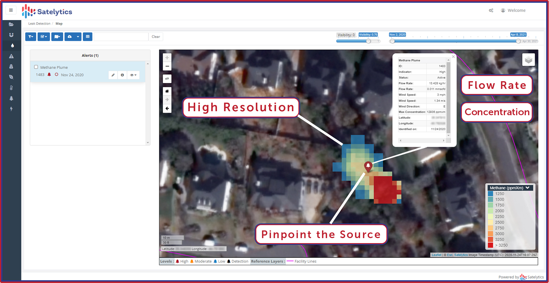
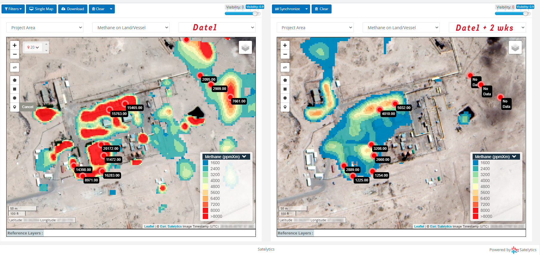
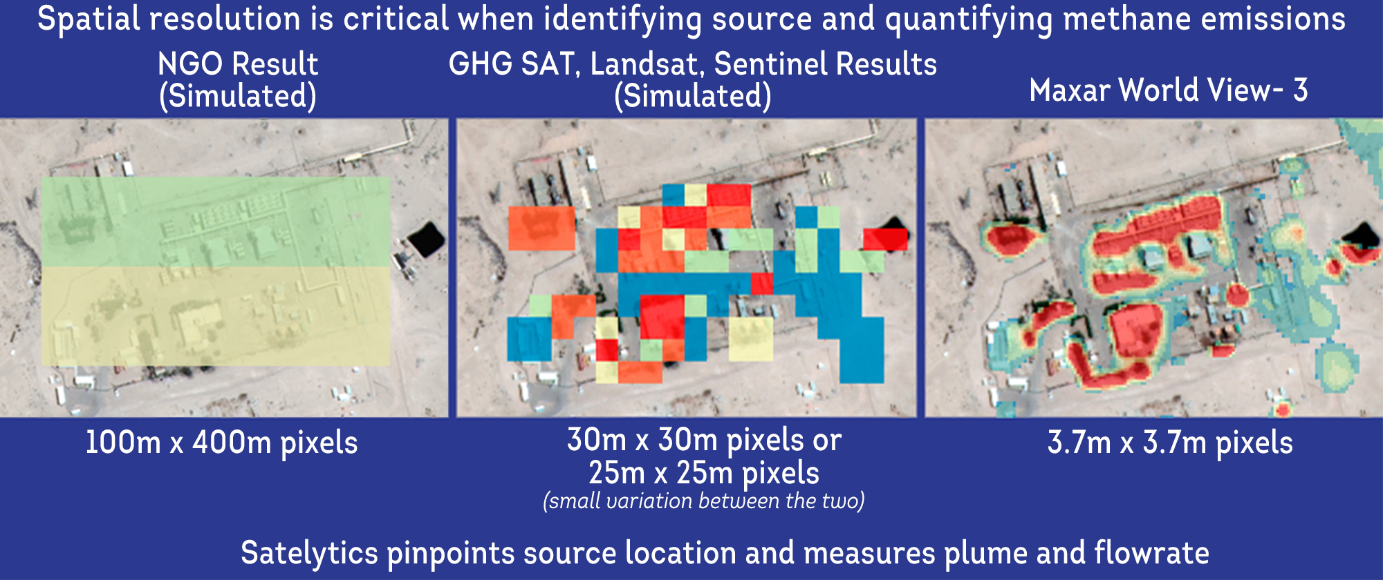
Some questions express doubts that satellite sensors have the resolution for quantifying small leaks. These questions are rooted in purposefully-misleading information put out by NGOs with an anti-energy agenda. The truth is that Satelytics uses high-resolution satellite data to pinpoint leaks as small as 9 kg/hr and plume concentrations as low as 250 ppmXm within 4 meters of their source.

Lastly, I often hear something to the effect of, “Satellites... aren’t those expensive?”
As another customer recently said, “the cost is significantly less than ground-based leak detection.” Commercial satellite data is sold by area, so any situation where assets are grouped tightly drives value even further. This is true for our natural gas utility, upstream, and midstream customers.
Satelytics can provide the exact cost for advanced leak detection of your assets — call us today to learn how.