• Power Utilities,Water & Wastewater
• Power Utilities,Water & Wastewater
Sure, satellite sensors can provide thermal measurements on land and water, but we don’t like to limit ourselves. Satelytics is a data-agnostic software platform, additionally processing imagery from aircraft, UAVs, fixed sensors, and more. We have the capability to fuse UAV data with satellite sources to provide a thermal solution for assets of any size.
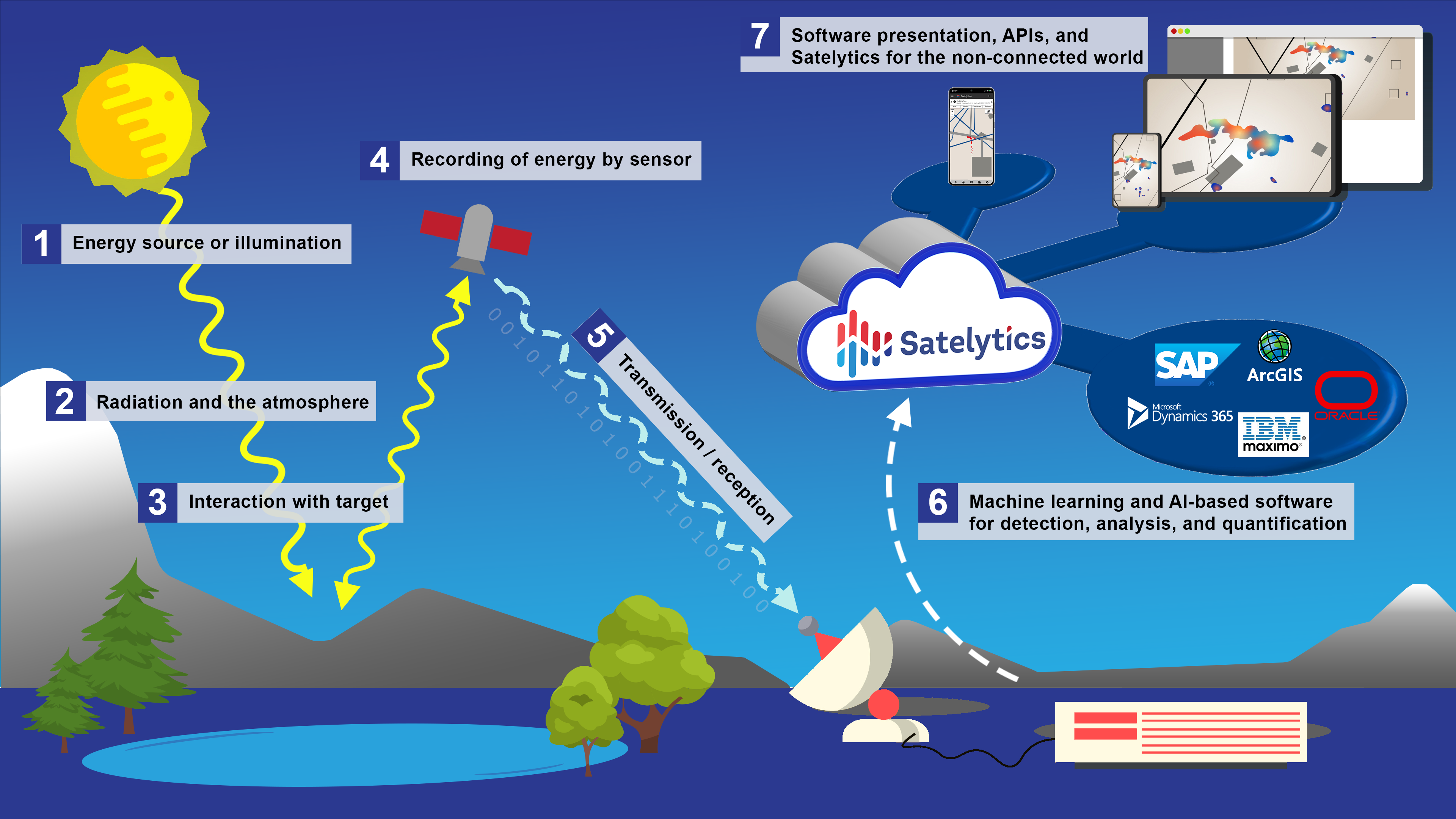
How Satelytics works
Our thermal measurements offer accuracy within ±1°C and satellite spatial resolution ranging from 30-meter to 30-centimeter pixels, custom-selected to match your needs. We also process UAV data with spatial resolution down a few centimeters — incredible resolution for the most intricate measurement needs. These measurements have been validated for accuracy on land, water, and other surfaces.
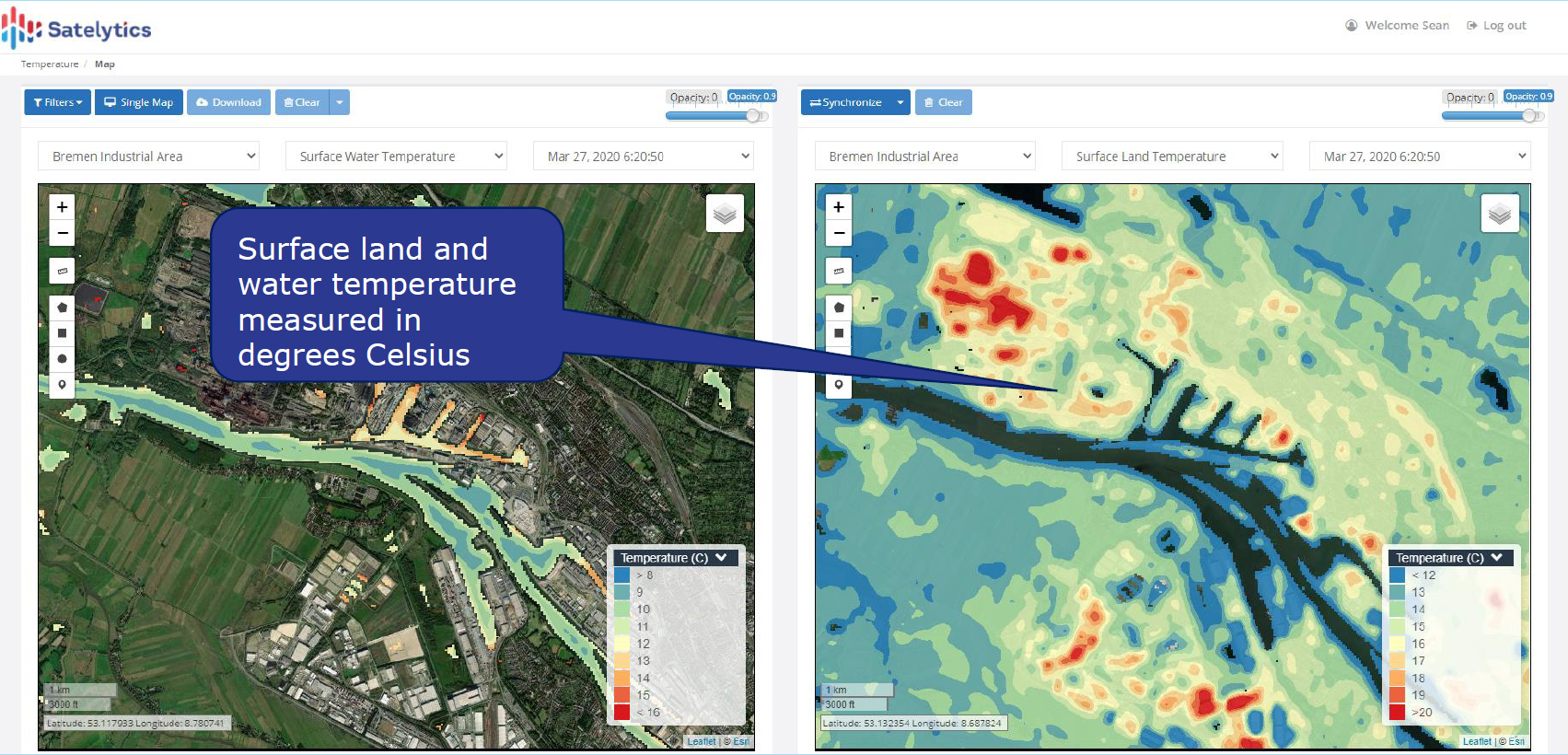
Water and land surface temperature measurement
Here are five ways our customers use thermal measurements:
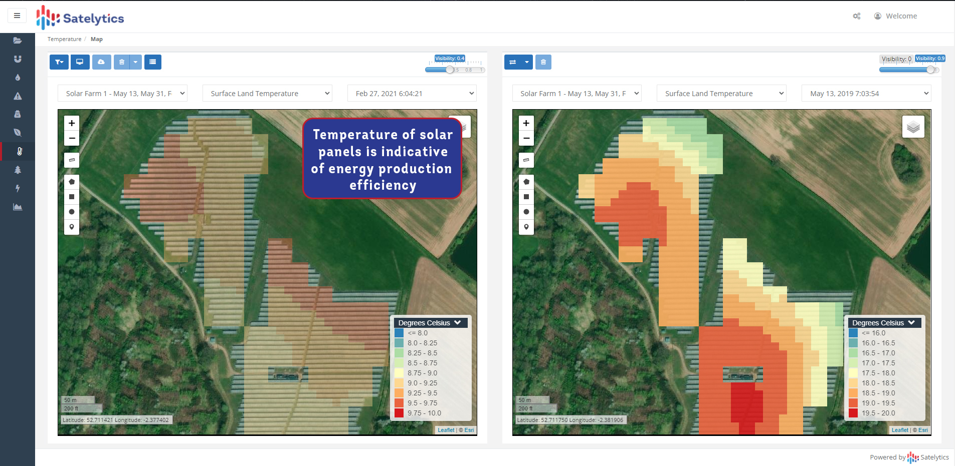
Monitoring solar panel temperature as an indicator of performance
These are just a few examples of thermal monitoring, and temperature is just one of 40+ algorithms offered by Satelytics — all of which can be obtained from a single set of satellite data. What areas of your business could benefit from this data?
We use cookies to analyze our web traffic and to enhance your experience. By continuing to view this website, you agree to our use of cookies.
Our Privacy Policy