• Forestry
• Forestry
There’s such a grand scale to what we do at Satelytics. Everything — from the sensors we task to the clients we serve — covers large swaths of area. But the problems we solve often start small.
Just like the trees of your forests, your problems may start small, but they grow.
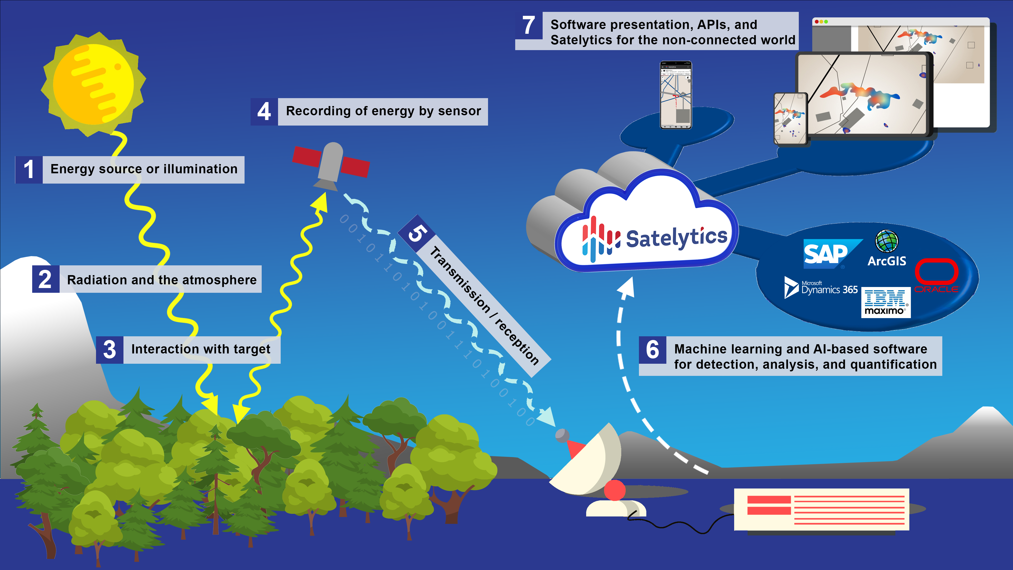
Alerting our customers to problems in their infancy is the essence of what we do. Satelytics sees the forest for the trees, meaning that with data collected from satellites and other sensors, our AI-powered software can help you keep track of and alert you to changes in tree speciation, health, height, and growth/decline — for each individual tree.
With this data, you can:
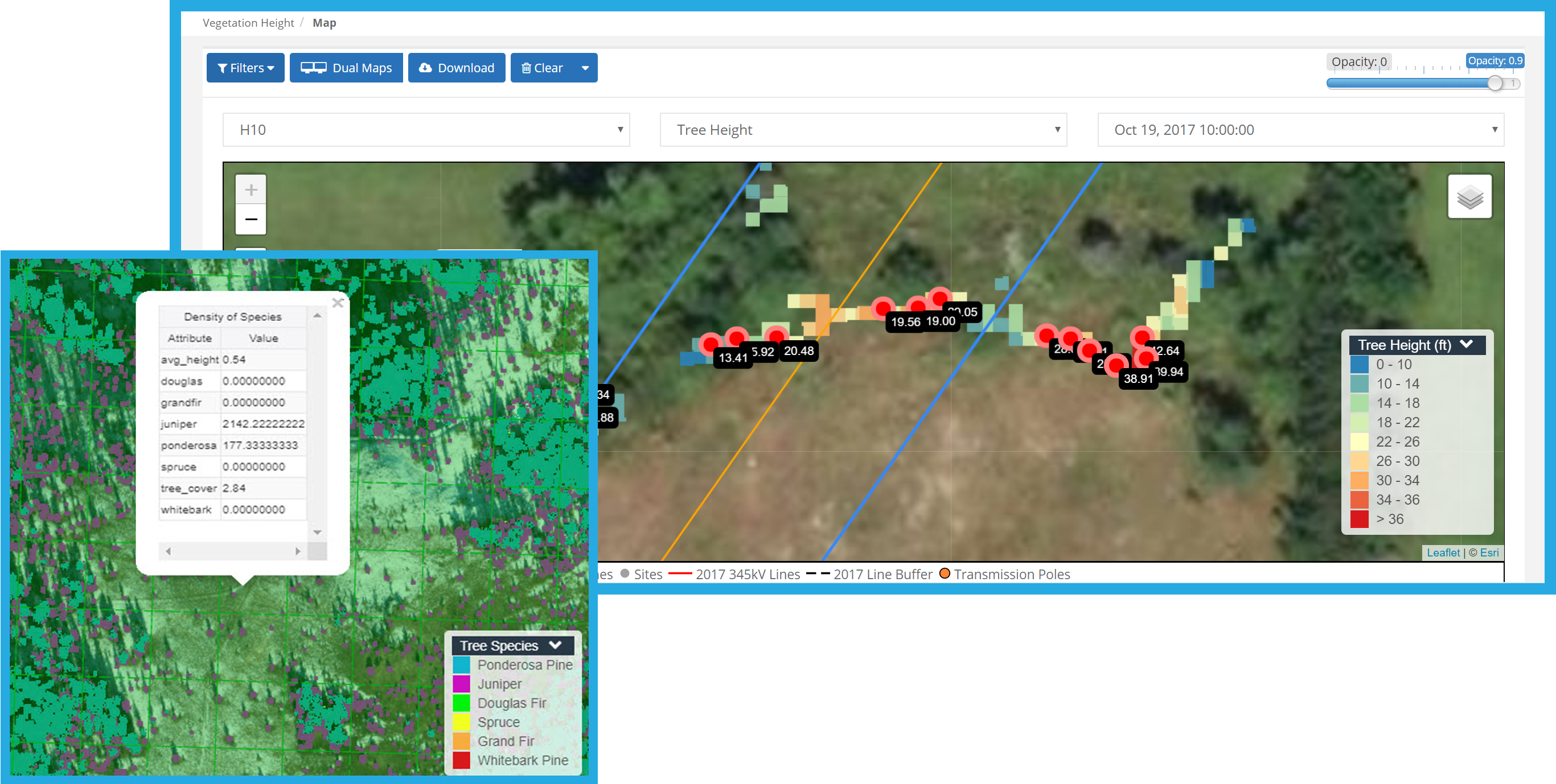

Satelytics sends alerts via SMS text and email, providing all measurements and details you need to know — including exact coordinates and magnitudes. Gone are the days of searching blindly for issues and unknown disasters. With Satelytics, you’ll have all the data to make informed planting and remediation decisions, including where to send resources and staff.
Vegetation crews will not only be better prepared for the job, they’ll also be able to complete it more efficiently with Satelytics for the non-connected world. Our mobile app allows crews to update alerts and add photos and relevant comments about the work they’ve been tasked with — no internet connection or cell tower needed. Once back in a connected area, the app uploads all field data to the cloud, available on your account to view for work verification.
Satelytics sees the forest for the trees, giving your organization peace of mind and allowing you to optimize operations.
We use cookies to analyze our web traffic and to enhance your experience. By continuing to view this website, you agree to our use of cookies.
Our Privacy Policy