• Power Utilities

• Power Utilities
Recently, an electric utility reached out to us after a vegetation management (VM) project with another satellite analytics company proved to be a less-than-optimal experience. The issue? Something we regularly preach: spatial resolution. While course resolution imagery saves money versus high-resolution imagery, you can’t “see” something smaller than the pixel size. That’s why Satelytics is committed to using the highest resolution data possible: the initial cost is higher — but the outcome is an actionable solution that works.
Utility vegetation management (UVM) presents unique challenges, but our partners at ACRT Services have helped us develop analytics to direct corridor managers to problem spots. This series will delve into Satelytics’ approach to UVM so you don’t find yourself in the scenario described above.

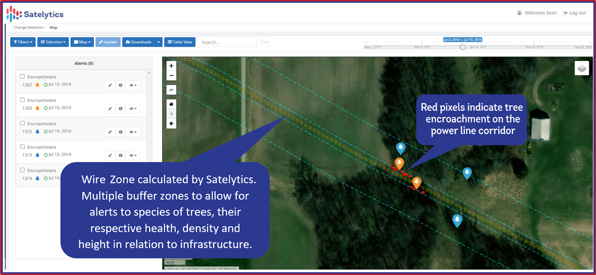
Satelytics begins with the width of our customers’ wire zone, centerline coordinates, and the overall dimensions of the transmission corridor to establish alert thresholds. First and foremost, we alert our customers to wire zone encroachments, determined by tree height and proximity. We’re able to identify not only a single tree, but individual branches, too.

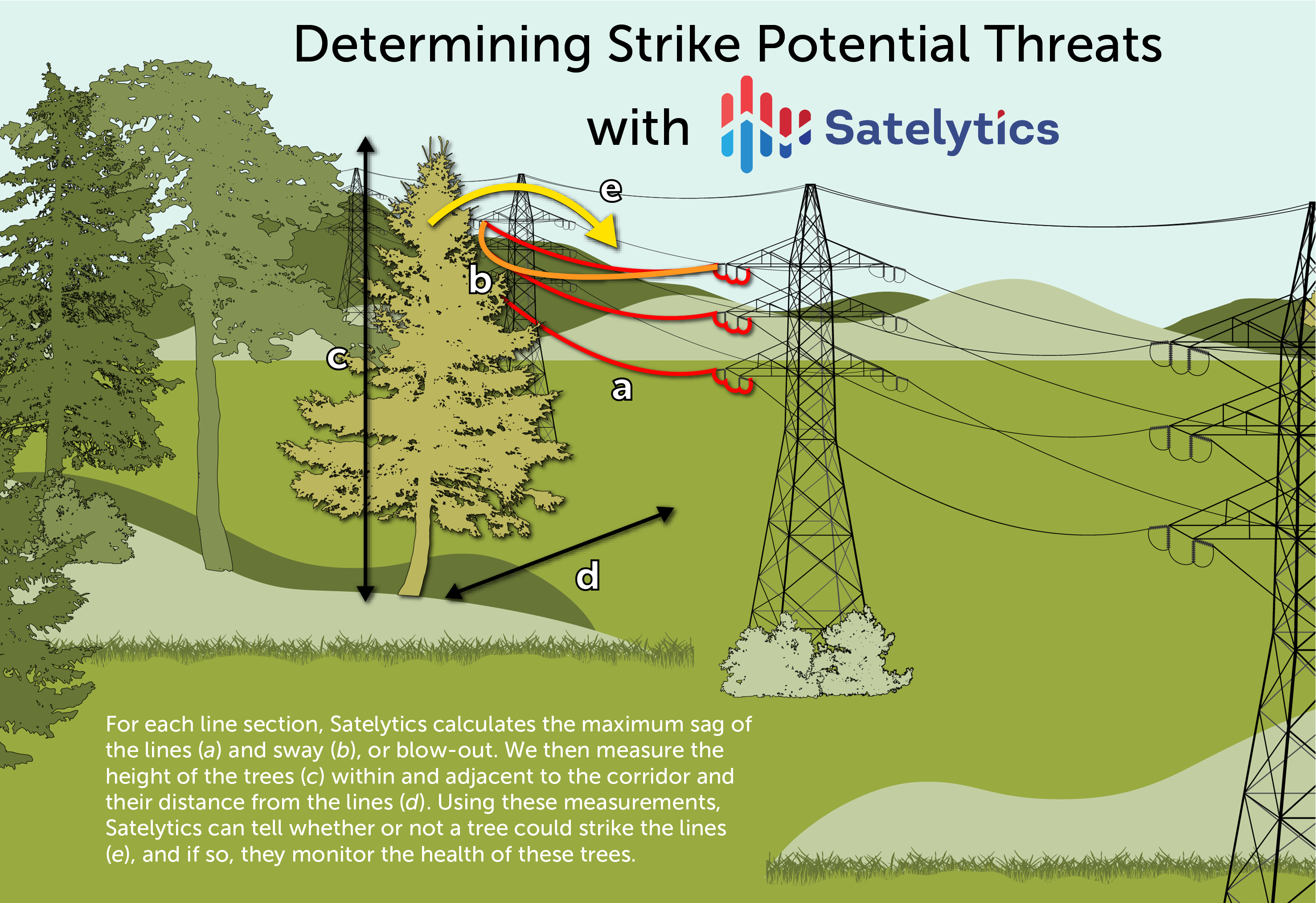
Measuring tree height also allows us to pinpoint potential threats adjacent to your transmission and distribution corridors for additional monitoring. For example, if a 100-foot-tall tree is standing 50 feet from the wire zone and fell toward it, the tree would hit the wire and transmission tower. If this tree declines in health (more on this in part two) to the point where it could fall, Satelytics issues a strike potential alert.

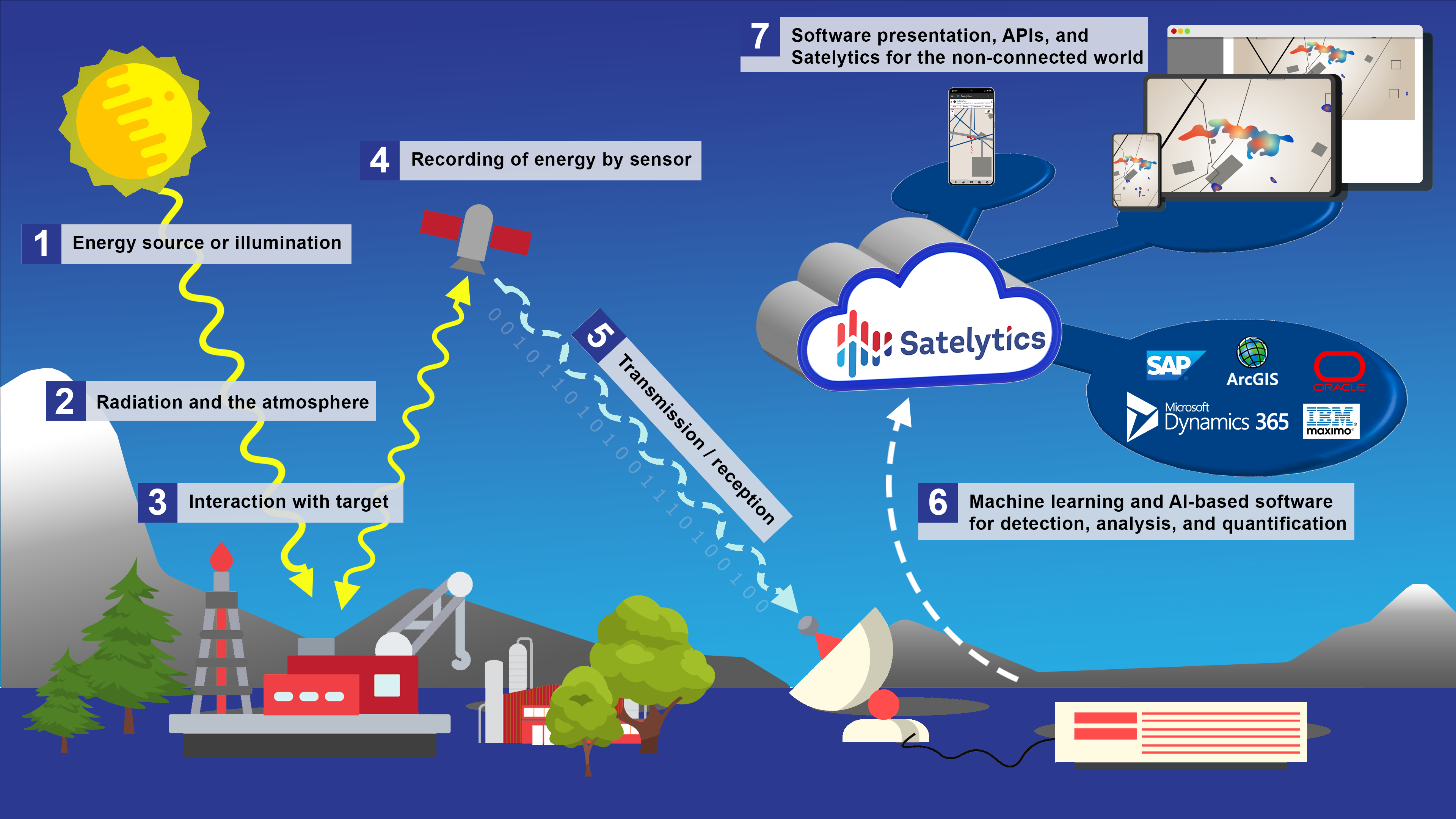
Incomplete utility vegetation management is costly and does not produce actionable results. Satelytics analyzes high-resolution satellite data with artificial intelligence and cloud computing to return actionable results in a timely manner, providing our customers with data to optimize and protect their operations, wherever and whenever.