• Electric & Gas Utilities

• Electric & Gas Utilities
What threat does wind present in damaging overhead utilities? Most overhead utility assets are engineered to handle substantial wind loads in a vast range of temperatures and environmental conditions. A customer recently told us their assets can withstand wind speeds approaching 100 miles per hour! Still, wind plays a big role in transmission and distribution line damage.
Assets don’t have to be blown over to cause a problem. In many cases, it’s encroaching and unhealthy trees that strike first —and severe winds just happen to blow lines closer to these strike potential threats.

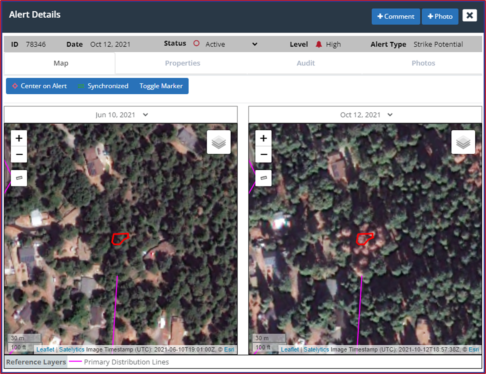
In a matter of months, perfectly healthy trees (left) along distribution lines have declined in health (right).
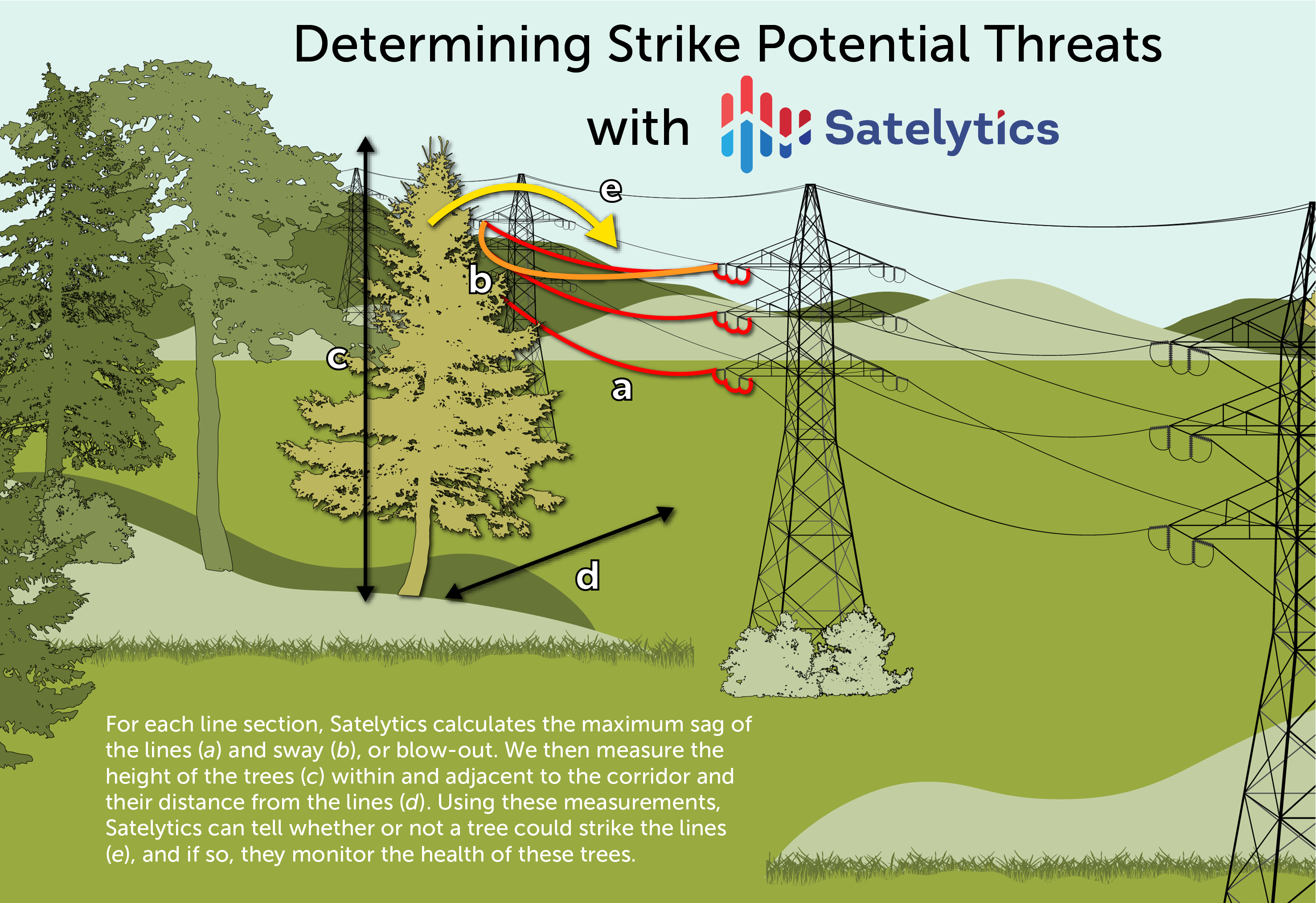
Commercially-available satellite sensors do not offer high enough spatial resolution to see power lines, so there’s some extra measurements we need to take into consideration to identify strike potential threats. When initiating a utility vegetation management (UVM) project, the customer provides us with their line voltage. This number allows us to calculate the wire zone in relation to the lines, a width set by regulations depending on line voltage.
Next, we calculate the maximum vertical displacement, or sag, of the lines. Knowing the maximum sag and wire zone coordinates, our algorithms alert customers to trees that are too tall and encroaching into the wire zone.

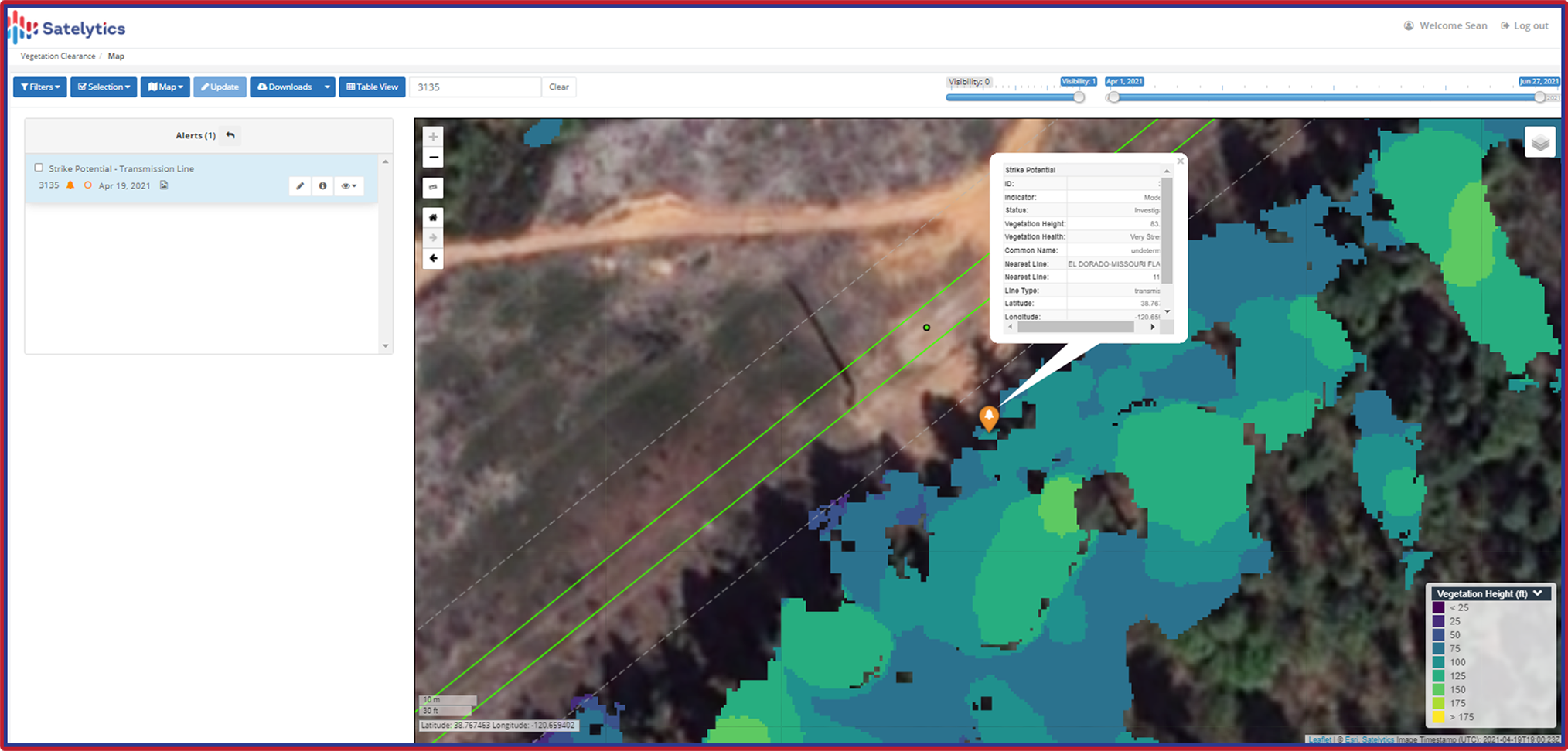
Satelytics measures the height of individual trees along T&D lines.
To determine strike potential threats — trees at risk of interacting with T&D infrastructure and power lines through proximity and/or declining health — we also calculate the maximum blow-out for power lines. Blow-out is how far out a power line will sway during wind gusts. Satelytics alerts our clients to strike potential threats and categorizes threat severity by analyzing several variables: tree height, tree health, proximity to assets, the location of lines at maximum blow-out, and the topography of the area.

By establishing wire zones and determining line sag and blow-out, Satelytics provides accurate alerts and data about threats to your T&D infrastructure — before disaster strikes. Don’t be left wandering any way the wind blows, searching for dangers to your operations. Let Satelytics show you where UVM crews need to go.