• Water & Wastewater

• Water & Wastewater
Spring is just around the corner. With the changes of seasons come environmental changes and operational challenges for watershed areas. Satelytics’ Constant VigilanceTM algorithms are uniquely designed to provide environmental managers with not just a view, but a fingerprint of what’s at work on land and in the water. Satelytics addresses three categories of challenges for watershed managers: biological, chemical, and physical threats.
Biological
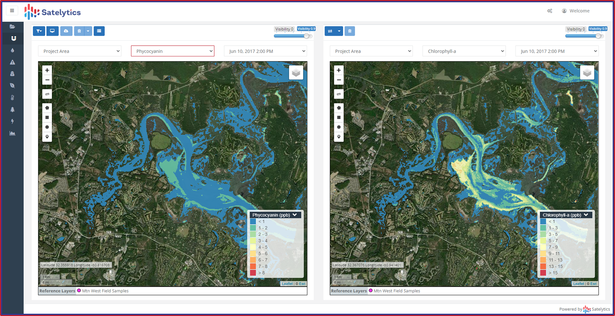
Together, phycocyanin and chlorophyll-a are the most common biological indicators of cyanobacteria and harmful algal blooms (HABs). Satelytics measures both indicators in parts-per-billion concentrations. Knowing the light wavelengths reflected and absorbed by phycocyanin and chlorophyll-a, Satelytics accurately quantifies these substances in waterbodies to a depth of 18 inches. If one or both are present in high concentrations, cyanobacteria and HABs may also be present.
Additionally, population growth drives the loss of buffering habitat along waterbodies. Satelytics monitors vegetation in and around streams and reservoirs. Hydrilla, seagrass, shoreline cover, trees: all can be detected and speciated with geospatial analytics.

Phycocyanin and chlorophyll-a can be measured at ppb levels.
Chemical
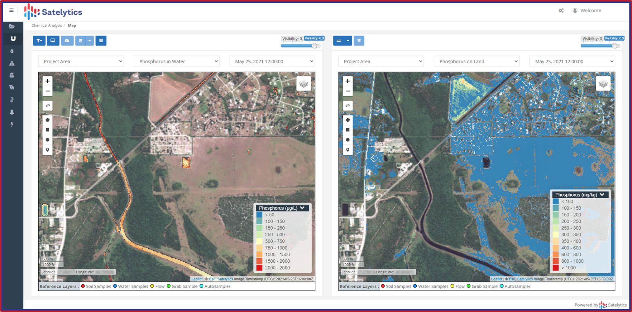
Phosphorous and nitrogen —two nutrients for HABs — often originate from agricultural and other human activities over which our customers have no control. Instead of guessing or relying on limited point source samples to monitor chemical and nutrient loading, Satelytics provides a top-down view for watershed managers on a frequency of their choice.
From the same data sources, our Constant VigilanceTM algorithms also detect and measure metals, hydrocarbons, total PFAS, and more.

See water chemistry gradients.
Physical
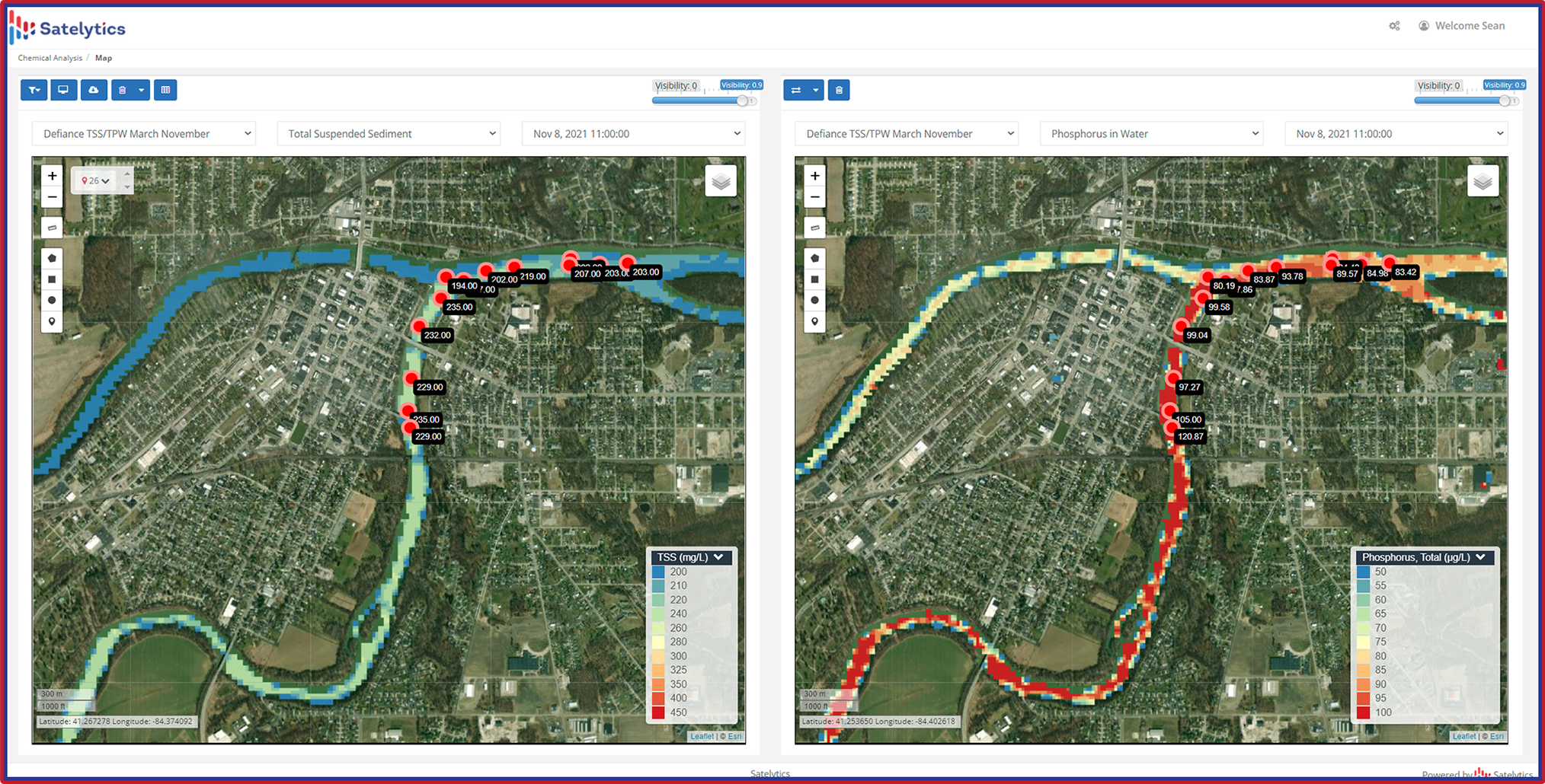
Our change detection capabilities give asset managers all the information needed to swiftly respond to threats like illegal construction, sedimentation, turbidity, total suspended solids, surface temperature, bathymetry, erosion, and land movement.

Measure watershed changes like total suspended solids.
All Satelytics’ algorithms are field-calibrated with our customers and third-party labs to ensure accuracy. Results are returned a few hours after imagery is gathered, which can be as frequent as daily, for locations of any size to meet our customers’ monitoring needs.
Satelytics replaces routine monitoring with a completely automated solution. Call us today for a demonstration to see what is possible!