• General

• General
From a young age, I have been fascinated by machines and tools. It is even better if the device can perform multiple tasks, aiding many projects. Take, for example, a tractor. It mows grass, cultivates, blows snow, clears brush, and excavates — one tool that tackles many outdoor jobs.
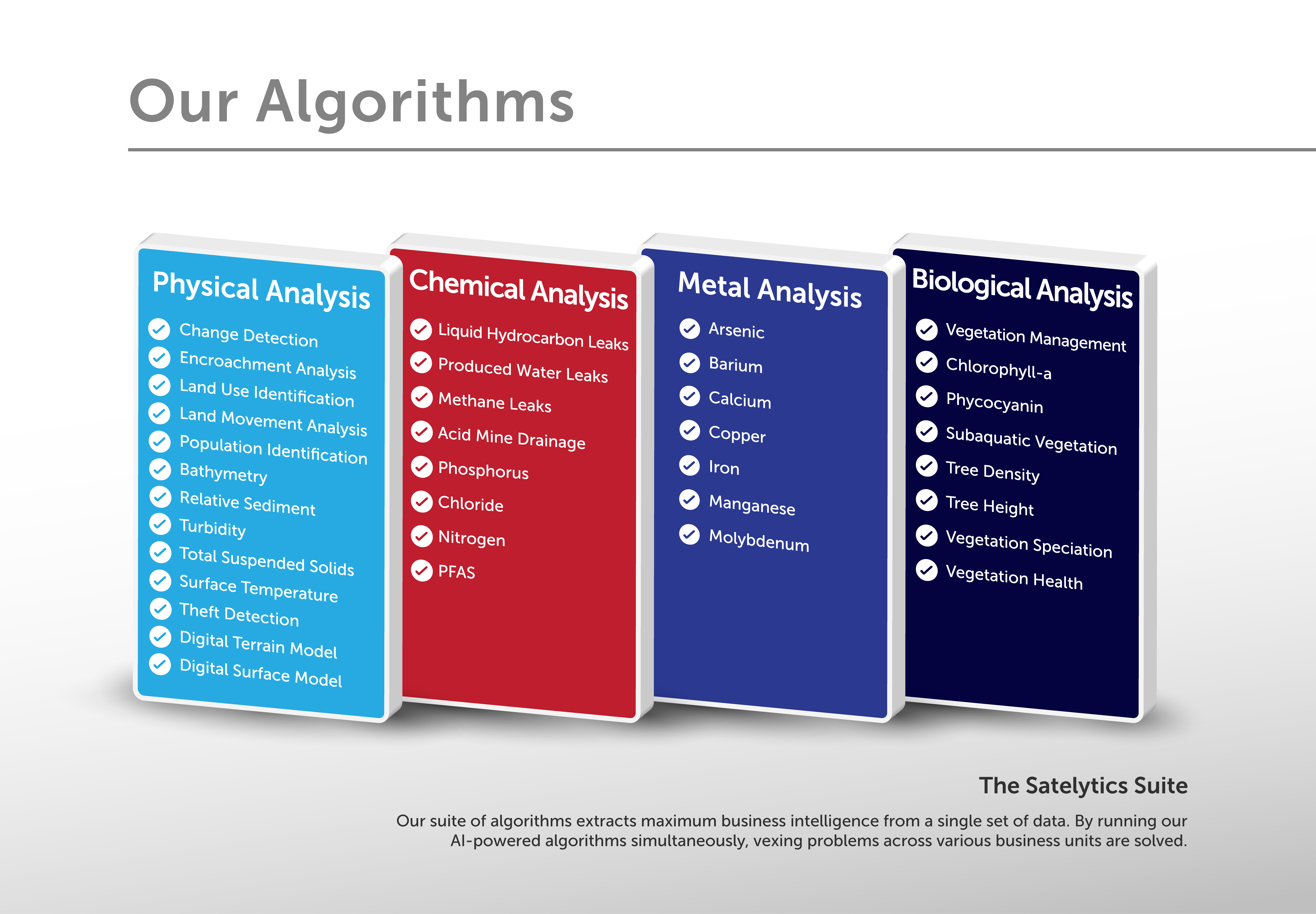
Similarly, Satelytics’ Constant VigilanceTM algorithms are designed — on behalf of our customers — to address challenges in parallel, benefiting multiple user groups within an organization. This three-part series will focus on the Satelytics solution: providing our customers with analytics for physical, chemical, and biological challenges in their many business verticals.

Satelytics' many algorithms.
Physical Analyses
The history of remote sensing and geospatial analytics is rooted in change detection. The first satellite offerings in the 1980s provided spatial resolution measured in hundreds to thousands of meters — groundbreaking at the time but not helpful in detecting small changes and threats.

Today, commercial spatial resolution is offered down to the square foot, providing alerts and measurements of physical objects and features as small as a dinner plate over vast land areas.
With the goal of identifying threats before they become a disaster, Satelytics’ customers are receiving our alerts multiple times per week. They have done the math — spending a dollar to proactively avoid spending hundreds or thousands of times that amount after a disaster makes sense for any budget.

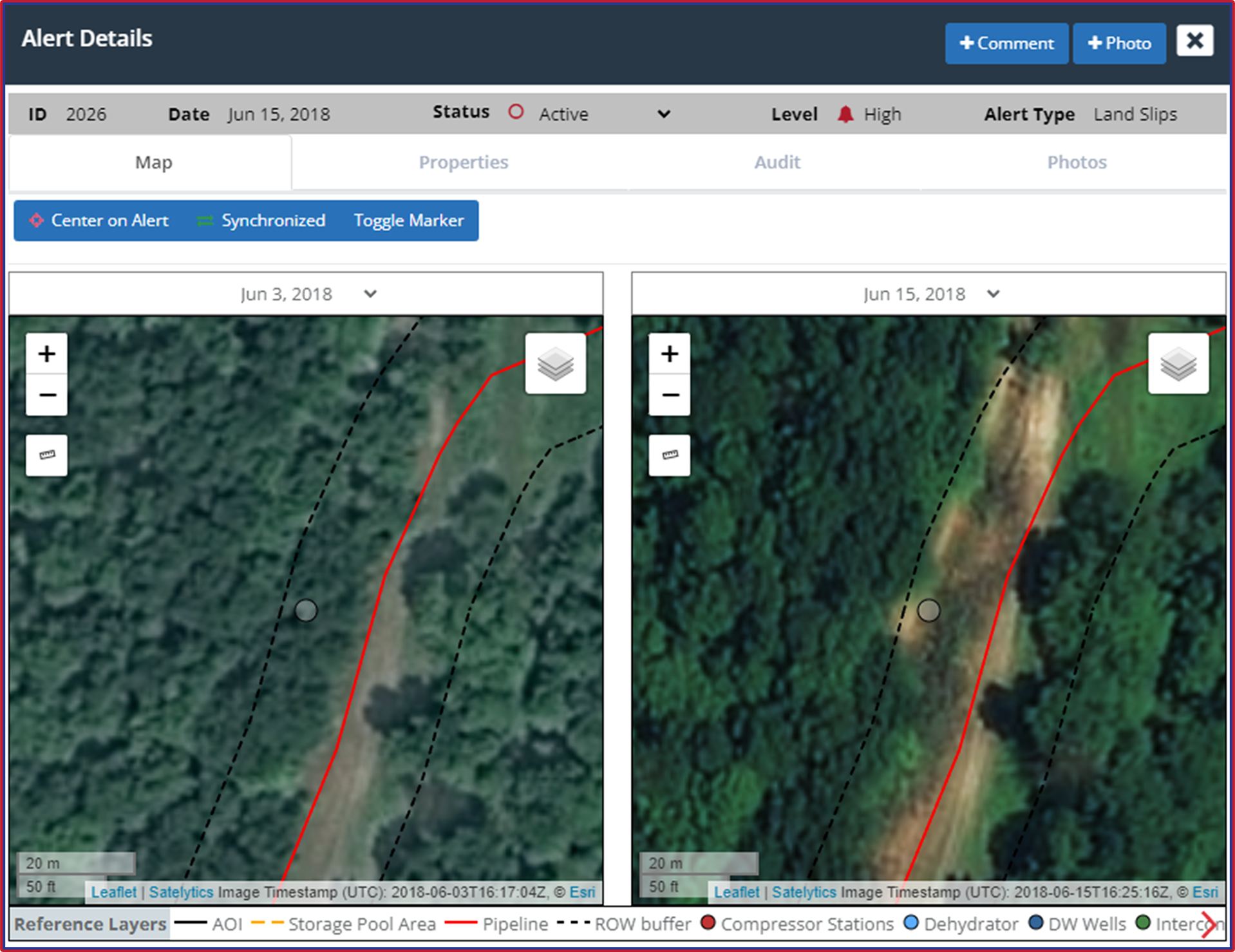
Catch events like landslides with Satelytics' physical analyses.
Satelytics’ customers are putting geospatial alerts and systems in place to save effort and expenses from unpredictable events across their business verticals. Our capabilities are continually expanding, too. What keeps you up at night?
Next, we will discuss the chemical and metal analyses Satelytics provides from the same set of geospatial data.