• Electric & Gas Utilities,Water & Wastewater
• Electric & Gas Utilities,Water & Wastewater
(adapted from an Airbus article released on 5/29/2024; read the full article here)
Georgia Power delivers power to more than 2.6 million customers. Each year, 1.1 million KW-hrs of electricity are generated by 16 hydroelectric dams around the state. Georgia Power’s Land Department manages 59,000 surface acres of water bodies and 100,000 acres of surrounding properties.
The most common threats relate to construction or expansion of structures on properties adjacent to the shoreline. Clearing the landscape of vegetation is another activity that is monitored. These activities can create conditions where soil, pollutants, and other unwanted debris drain into the reservoirs. Reinforcing bulkheads and building docks can similarly impact water conditions and shoreline aesthetics. Private landowners planning development on their properties often don’t realize special permitting is required for projects in the buffers and watersheds around the lakes associated with hydroelectric generation.
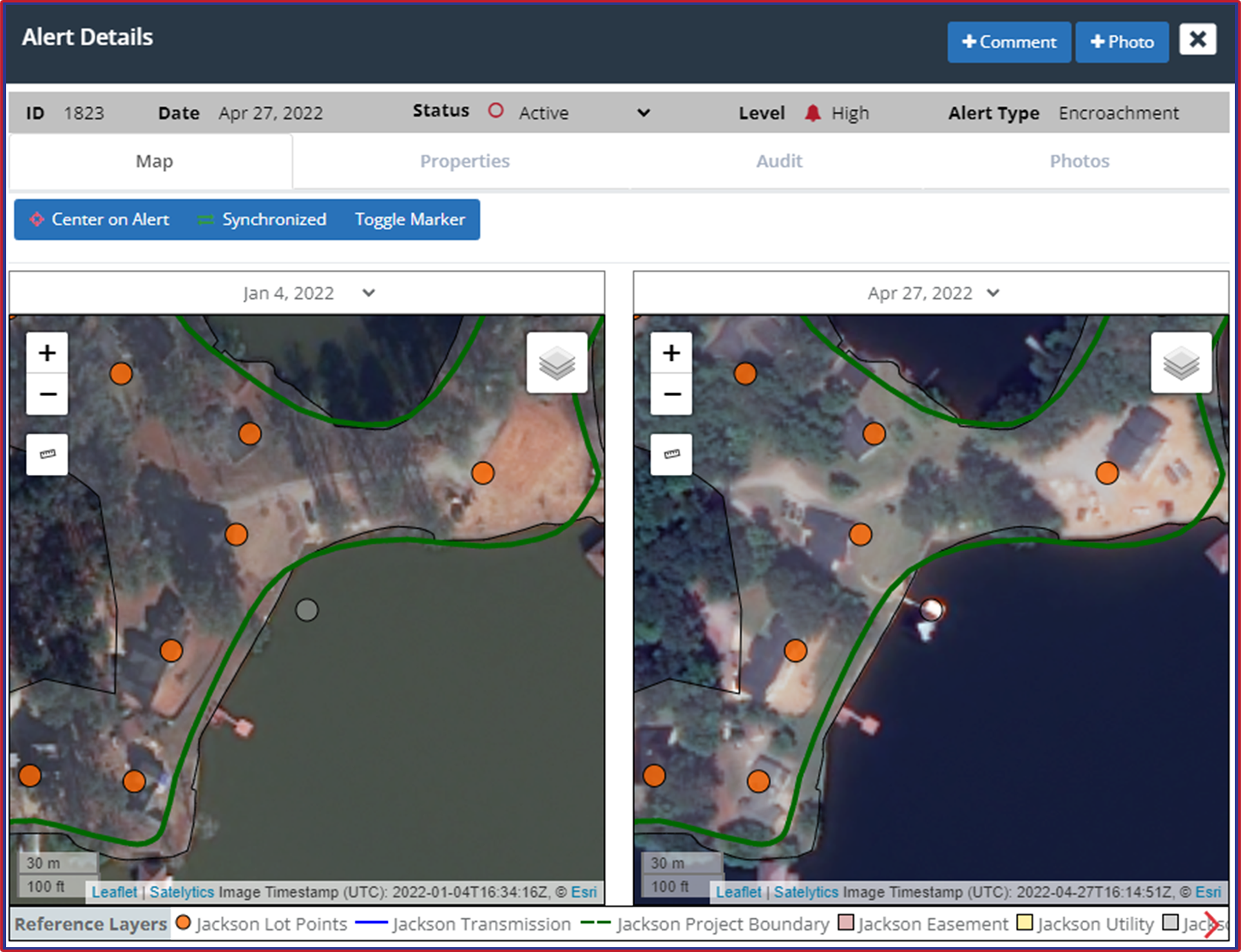
Alert indicates a structure has been built, indicating a possible risk.
In 2016, Georgia Power turned to Satelytics to automate much of the shoreline surveillance process. Satelytics analyzes satellite imagery of the lakes and their buffer zones four times yearly. We deliver actionable alerts and measurements on land disturbances, vegetative clearing, and other signs of construction on land or at the shoreline itself. Separate algorithms detect aquatic plant growth in the water to depths of up to two feet. We also employ change detection algorithms to pinpoint subtle differences in the terrain, vegetation, and building structures from one season to the next.
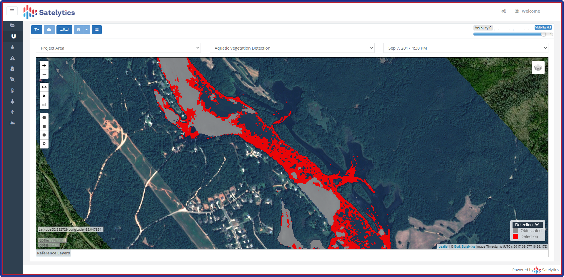
Subaquatic vegetation detection pinpoints potential risks to the hydroelectric system.
Georgia Power has said that their teams are finding more noncompliance issues now than they did before employing Satelytics. Timeliness is key to the value of the information, so Georgia Power is now harnessing our application programming interfaces (APIs) to deliver information directly into their existing work order management system.
The Land Department’s success with AI-based satellite image analysis has not gone unnoticed at Georgia Power. Other departments within the utility, including Vegetation Management, are now considering adopting the Satelytics technology for other monitoring applications.
Want to learn more about how you can harness geospatial analytics to improve your operations? Give us a call!
We use cookies to analyze our web traffic and to enhance your experience. By continuing to view this website, you agree to our use of cookies.
Our Privacy Policy