• Power Utilities
• Power Utilities
Problem: Vegetation risks to corridor.
Solution: Apply expertise only where needed.
Benefit: Improved monitoring and workflow.
Satellite-based geospatial analytics is seeing tremendous growth in the electric utility sector, driven primarily by utilities’ need to keep vegetation clear of overhead conductors. Asset managers are also concerned with the management of grasses and land on the floor of corridors. Utilities are realizing that a geospatial analytics program can solve today’s ubiquitous personnel pinch by applying expertise where expertise is needed rather than wasting it on routine monitoring and surveys.
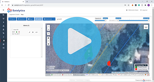
View a demonstration of a few of the UVM functions Satelytics offers.
Satelytics makes it easy to get started with an advanced infrastructure monitoring program. All we need to provide pricing is a definition of the asset area to be monitored. Satelytics returns exact pricing within a few business days, including several options for monitoring frequency and contract length. The cost includes the procurement of the satellite data and our Constant Vigilance monitoring platform, which has unlimited users and data stored in perpetuity on the cloud. You tell us when and where to focus our analytics, and we handle the rest.
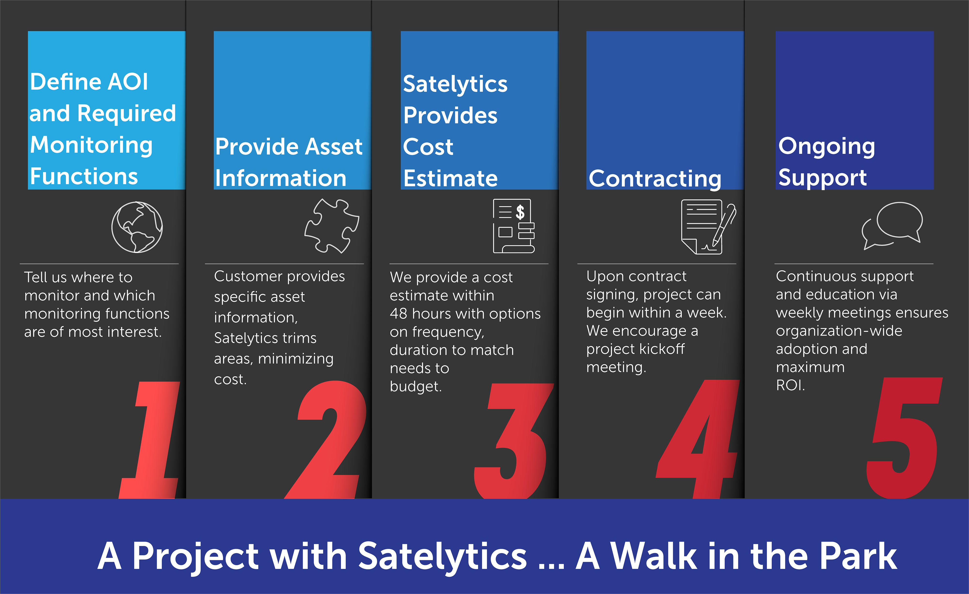
Before monitoring begins, an accurate shapefile of T&D infrastructure, including substations and buried conductors, is vital so encroachment alerts can be accurately generated in three dimensions. Because Satelytics analyzes imagery with a spatial resolution of 50 cm pixels or better, tree height can be measured within 5% of actual. If inaccuracies exist in the recorded locations of key pieces of infrastructure, our algorithms can help correct the GIS record.
We also require customer-provided information on line voltage (for calculating the wiring zone), pole and tower heights, and common species of trees found in the area to be monitored. All this information feeds our VM algorithms to provide strike potential alerts that consider size, health, and species of trees, along with infrastructure conditions like line sway and capacity.
Once a contract is signed, a training session is conducted where unlimited users are provided with access to our web platform, satelytics.io, where project results are curated. Alerts can also be passed to the customer’s existing business software via application programming interfaces (APIs). The customer can receive first alerts in as few as ten days after contract signing.
Simplify your workflow with an easy implementation of Satelytics’ Constant Vigilance utility vegetation monitoring platform. Contact us today to learn more.
We use cookies to analyze our web traffic and to enhance your experience. By continuing to view this website, you agree to our use of cookies.
Our Privacy Policy