• General
• General
A recent conversation with a customer in the pipeline industry highlighted a significant challenge: “We struggle with encroachments and change detection. We've tried satellite monitoring directly with imagery providers, but those projects failed miserably, unable to identify large buildings constructed within our corridors.”
At Satelytics, we have been delivering reliable change detection solutions for years, leveraging AI-powered algorithms trained on trillions of pixels of satellite imagery to consistently deliver accurate results. While imagery vendors excel at providing high-quality raw images and raw multispectral data from their satellite constellations, we specialize in the analytics required to transform that data into actionable measurements and alerts.
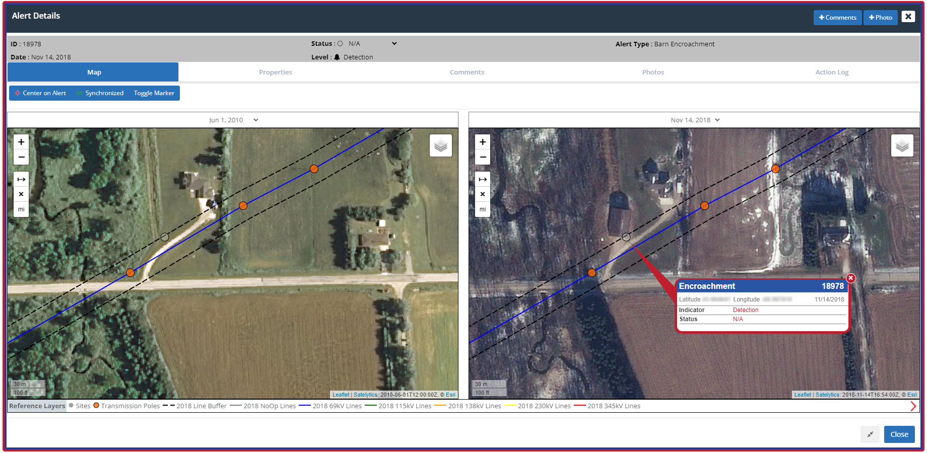
Barns, vehicles, pools, ... spot things that are where they should not be.
A common issue with many “satellite monitoring” offerings is that they rely on imagery experts rather than analytics specialists. Our focus at Satelytics is solely on geospatial analytics, and simple change detection is central to any advanced monitoring program we offer. We firmly believe that transforming raw data into actionable alerts is paramount to successfully serving our energy sector customers' real business needs.
Our change detection solution relies on high-resolution satellite imagery. We understand that only images with a spatial resolution of 50 cm or better can accurately identify construction, excavation, geohazards, vehicles, structures like sheds or barns, pools, vegetation, liquid leaks, and other activities. Our geospatial algorithms employ a dual approach to change detection. First, we analyze every pixel within the Area of Interest (AOI) to detect any changes since the last analysis. If a change is identified, our AI examines the pixels in question, seeking to recognize the object based on historical data. This quantification step sets Satelytics apart in the realm of advanced satellite-based change detection.
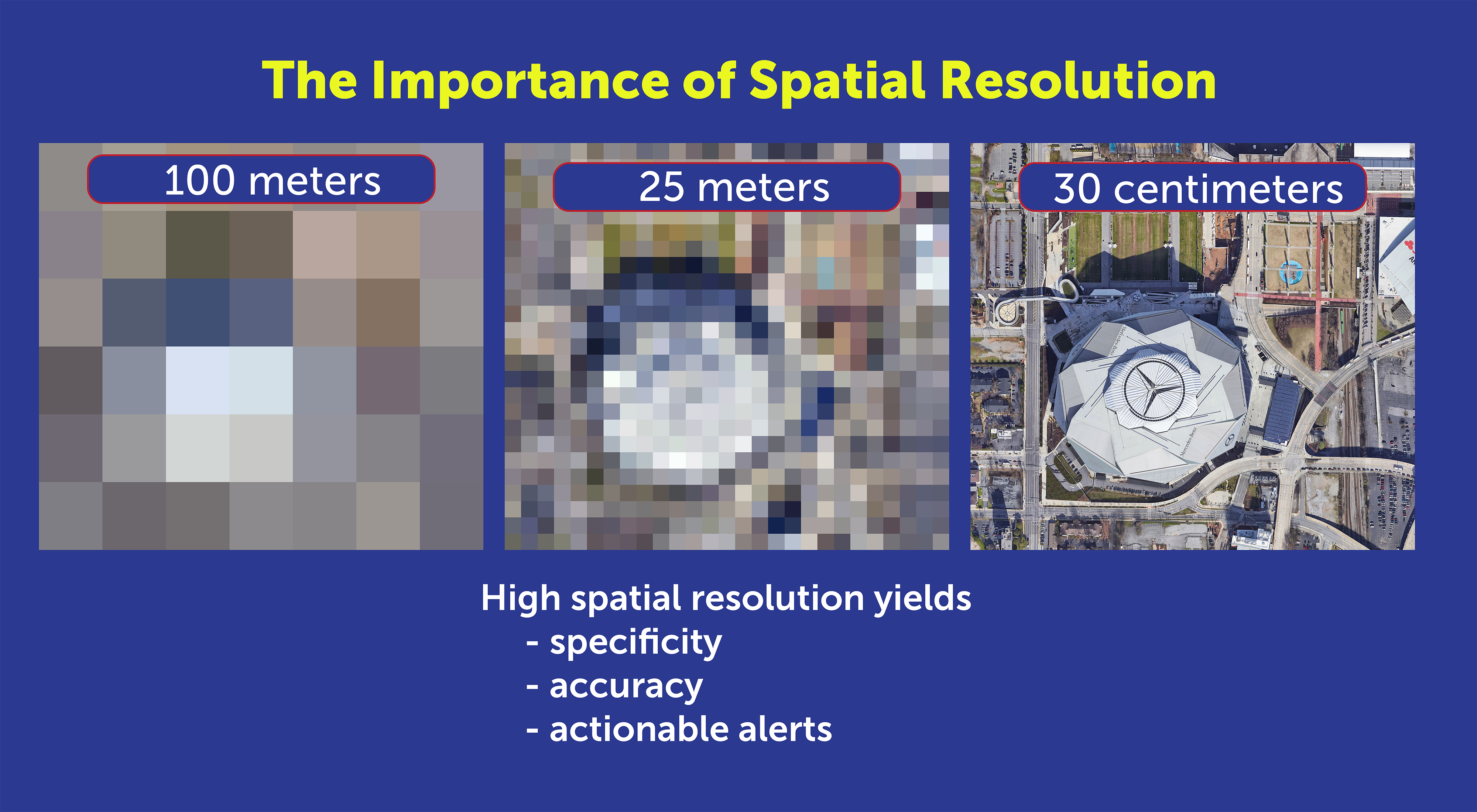
There are no small encroachments, so spatial resolution matters!
You may wonder, “But isn’t this expensive?” The answer depends on the challenge at hand. If a threat is causing damage, it inevitably incurs remediation costs. The quicker we identify the threat, the lower those costs are likely to be. Attempting to conduct change detection with an ineffective solution is simply a waste of resources.
By prioritizing analytics, we transform complex data into clear, actionable alerts, helping to mitigate risks and reduce costs. If you are ready to enhance your monitoring processes with a partner dedicated to delivering precise geospatial insights, contact Satelytics today to discover how we can tailor our solutions to meet your unique needs.
We use cookies to analyze our web traffic and to enhance your experience. By continuing to view this website, you agree to our use of cookies.
Our Privacy Policy