• General

• General
Many organizations are stretched thin, both financially and from a workforce standpoint. Satelytics’ geospatial analytics can fill the gaps and stretch budgets further — all without needlessly sending crews into the field.
We separate ourselves from the rest by being data agnostic, sourcing raw imagery from any number of commercial vendors to get the highest quality data for your project. Satellite coverage offers daily revisit of locations worldwide. Revisits are even possible multiple times a day for some locations, and this frequency will only increase in the future.

After imagery is acquired, the datasets are transferred to the cloud for processing. With pixel sizes down to the square foot covering thousands of square miles of our customers’ asset areas, the quantity of data processed is often measured in terabytes! Satelytics processes and stores project results in the cloud for best-in-class data security and an unlimited data library as projects expand in size and duration.

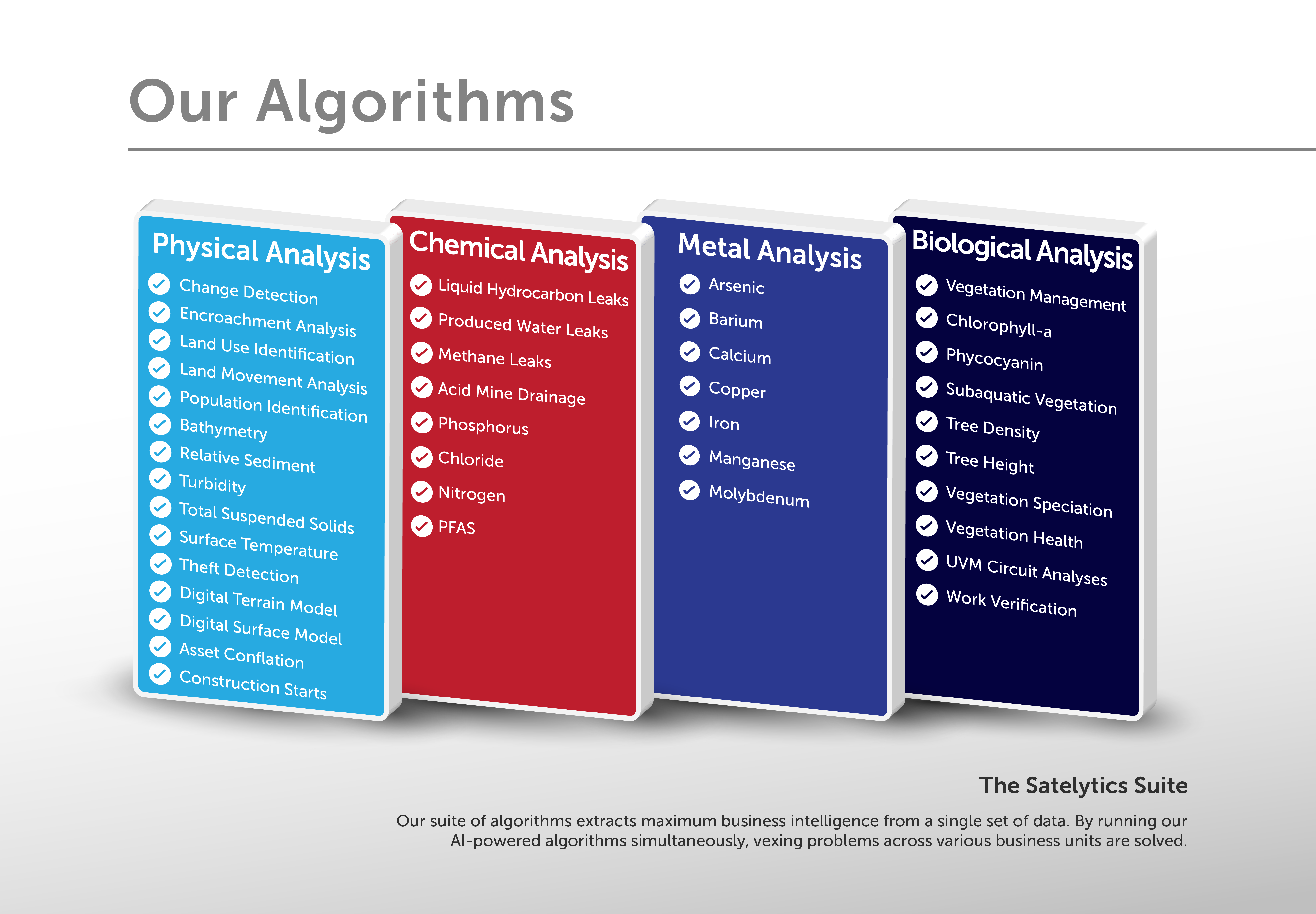
The final ingredient is Satelytics’ Constant Vigilance™ algorithms, over 40 of which run simultaneously on a single image, offering vital insights and measurements. Our models have operated over large infrastructure areas worldwide, detecting — and many instances quantifying — constituents from above. With accurate alerts, field crews are sent only to locations needing their immediate attention.
When employees and budgets are a precious commodity, Satelytics’ end-to-end solution works for you. Request a demonstration today to see how Satelytics saves time, money, and resources.