• Electric & Gas Utilities

• Electric & Gas Utilities
Like any household that operates on a budget with set income and expenses, a regulated utility faces similar limitations, albeit on a much larger scale. One large line item in any utility’s budget is vegetation management. Our customers tell us that vegetation management is also one of the first categories to be scavenged when unplanned expenses arise, robbing Peter to pay Paul.
So, if a vegetation line item is funded to complete only half the work needed yearly, how can a utility create efficiencies to make up the difference?
The advent of geospatial analytics provides an answer. A superficial analysis might say, “Just another expense!” However, after digging deeper, many utilities have determined that correctly applying these new tools helps the utility direct its experts only where needed, thus saving money.
How? Satelytics vegetation algorithms analyze satellite imagery to provide actionable measurements for system managers to prioritize which tasks should be completed first to reduce overall risk to T&D assets. High-resolution satellite imagery (spatial resolution of 50 centimeters or better) is available daily for any location, facilitating the granularity and bandwidth necessary for rapidly surveying large asset areas as often as needed without sending a utility’s vegetation experts on endless scouting missions.

Survey large asset areas; obtain specific, actionable results.
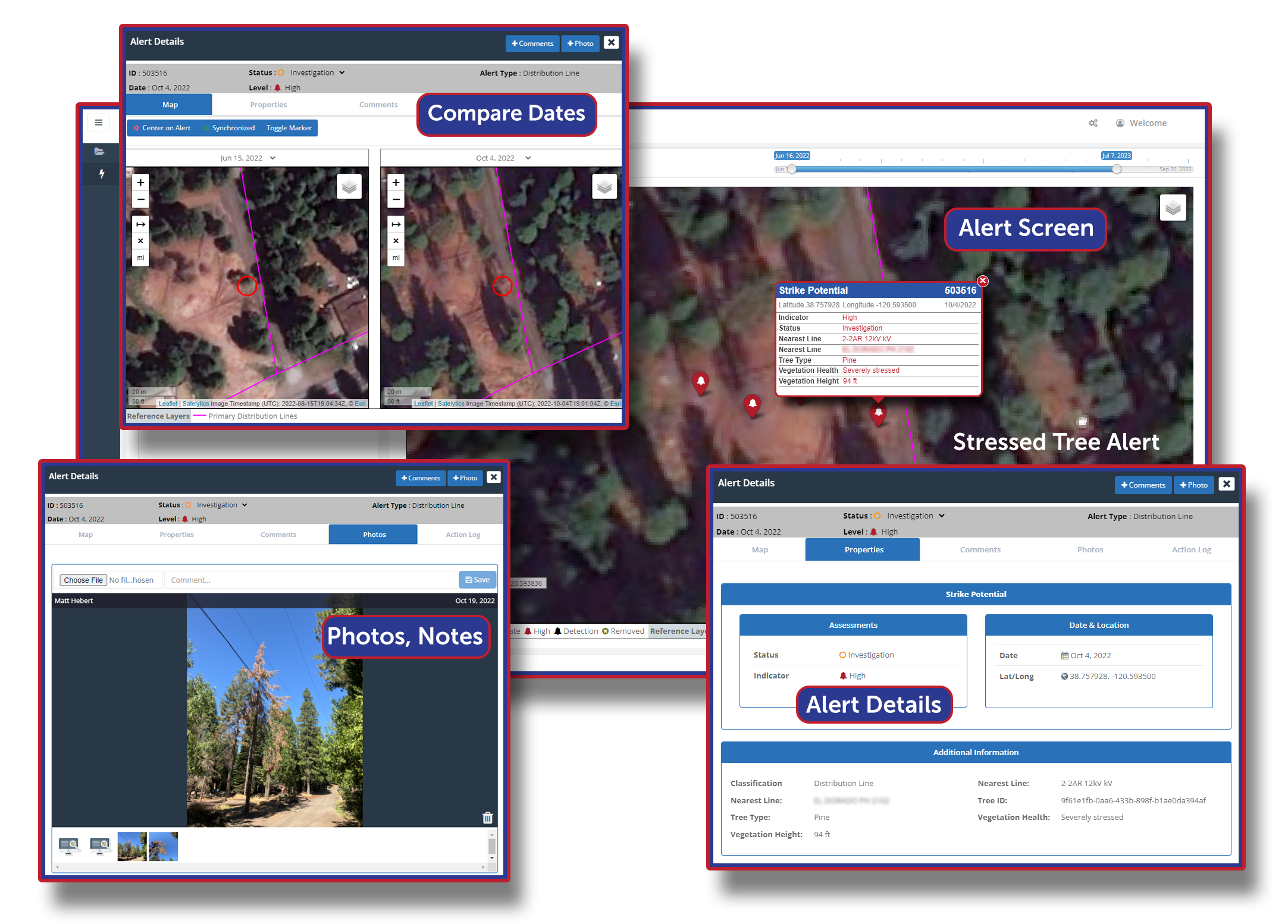
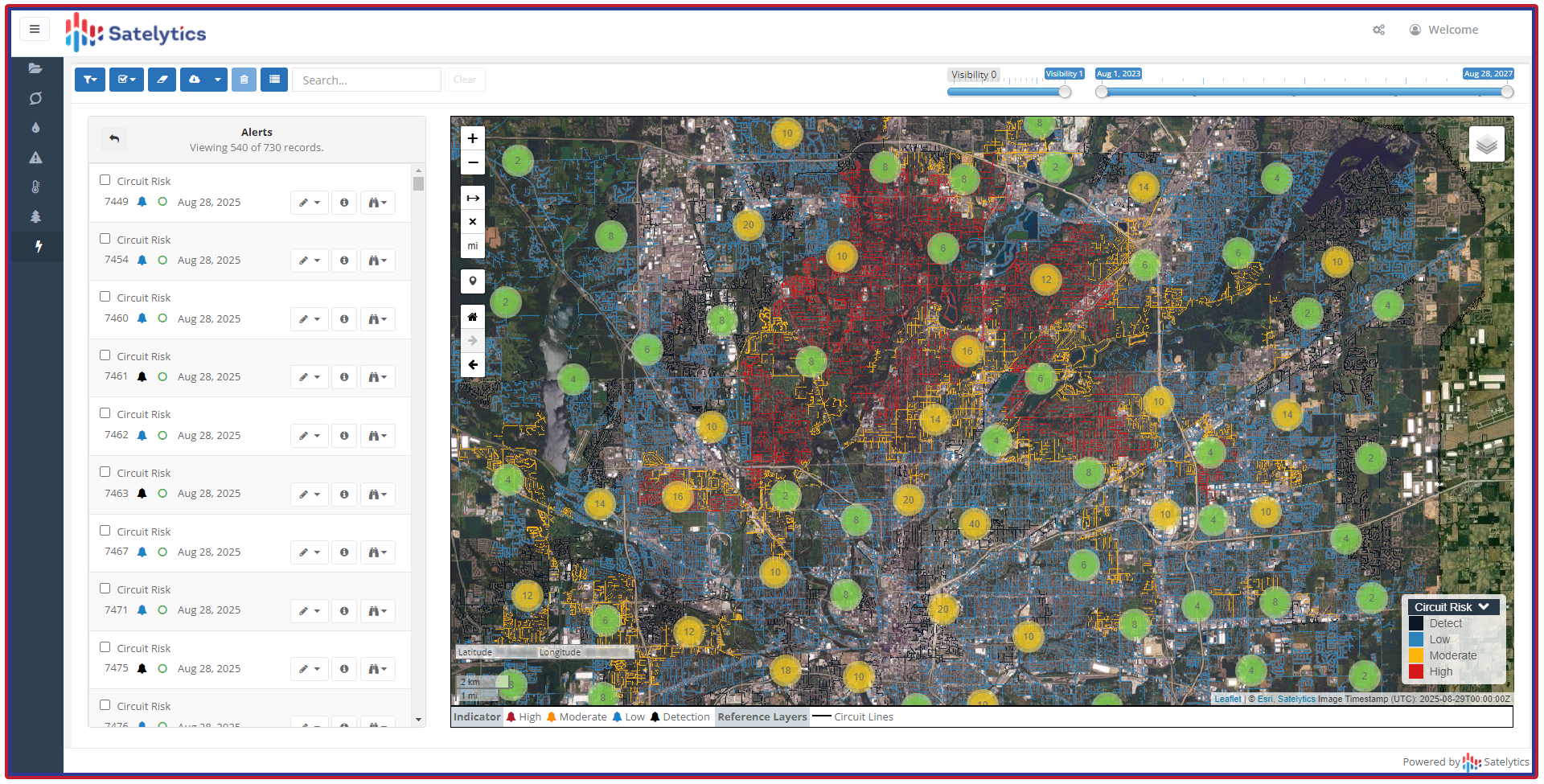
The granularity of Satelytics’ results allows tasks involving individual trees or circuit-sized projects to be planned. Satelytics’ vegetation management algorithms quantify tree height, species, health, physical encroachment, and strike potential along electric corridors. From the same imagery, we can also alert utilities on ground conditions, including invasive grass species, brush, geohazards, structural encroachments, and loss of cover. A recent update to our vegetation management solution is a circuit risk assessment that implements either a standard growth model or your custom growth model to predict future threats to your assets. The predictive data can feed budgets and bid packages as asset managers plan multiyear cycles.

Circuit Risk Analysis.
With this data, our utility customers prioritize dollars, expert labor hours, and equipment for their VM activities. Satelytics geospatial data guides vegetation maintenance decisions for fixed budgets and thus helps utilities compensate for inadequate budgets.
Call us today to explore this deeply and learn how other utilities are stopping the Peter/Paul conundrum.