• General

• General
Satelytics is at the forefront of analytics, on a mission to turn raw satellite imagery into actionable alerts for operators of large infrastructure systems. To understand Satelytics, you must also grasp how satellites survey our planet.
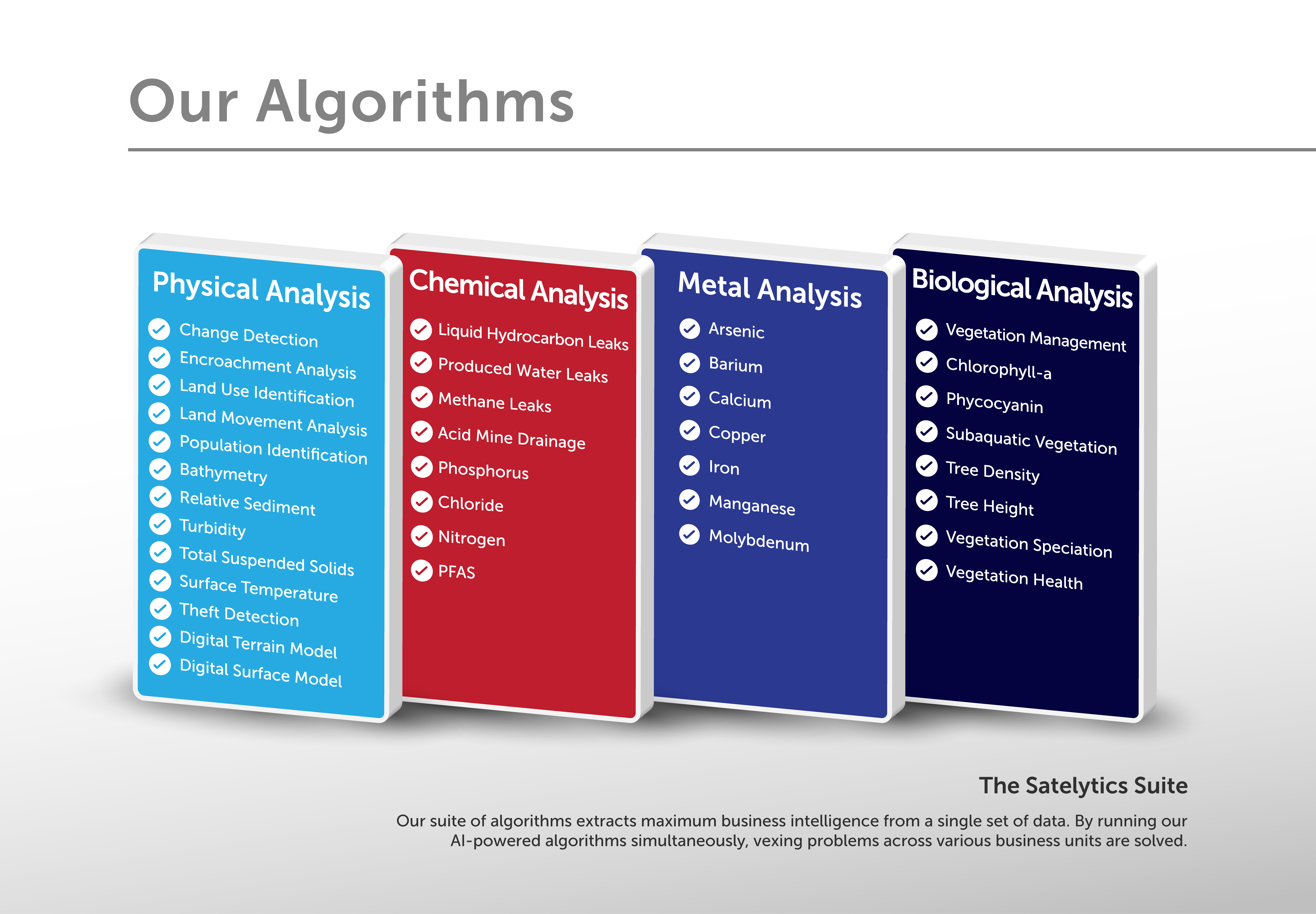
With over 40 AI-powered algorithms, Satelytics analyzes satellite imagery to deliver timely alerts about potential threats to energy infrastructure. Today, we can access daily imagery from countless commercial vendors and public satellites worldwide. What sets us apart? Our algorithms, crafted by some of the brightest minds in geospatial analytics, are rigorously tested in the field alongside our customers to ensure accuracy right from the start.

40+ algorithms solving multiple challenges by analyzing one set of data.
Satellites gather imagery in two main ways. The first is called "tasking," where operators point their sensors at a specific area of interest, guided by Satelytics and our customers. As the customer, we just need you to share the GIS shapefile of your infrastructure. Then, we’ll coordinate with the satellite vendor to capture only the data you need, avoiding costs and delays associated with analyzing unnecessary data. Tasked satellites typically feature high-resolution sensors with 30-50 cm pixel sizes, allowing us to detect small threats early—critical for our customers. Whether it's minor encroachments, geohazards, vegetation threats, or liquid and methane leaks, tasked imagery helps us spot these issues before they escalate.

Spot issues before they escalate.
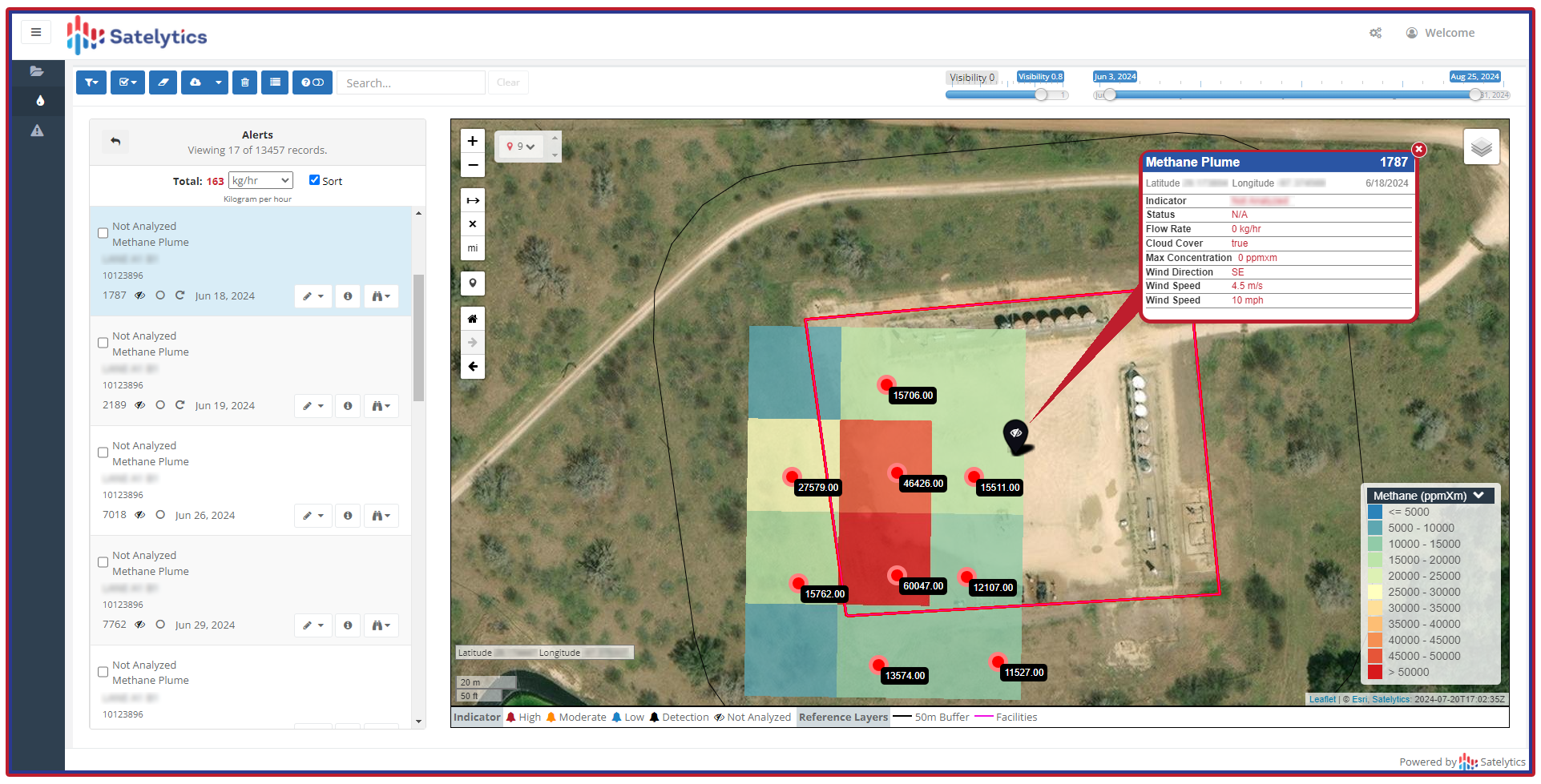
The second method is continuous imagery acquisition, where satellites gather data as they orbit the Earth. While these satellites generally offer coarser spatial resolution, measuring several meters per pixel, they provide invaluable public data at little or no cost. Currently, our only algorithm that processes this type of imagery is our Global Methane™ offering, which captures asset area data up to seven times a month. This solution has gained rapid traction in the oil and gas sector this year, especially with new WEC and super-emitter regulations on the horizon.

Global Methane™ example.
Whether through tasking or continuous gathering, the real magic lies in the science behind Satelytics’ algorithms, transforming mere images into actionable insights that can effectively safeguard large asset areas. Call us to explore how infrastructure operators are harnessing the power of AI-based analysis of satellite imagery!