• Electric & Gas Utilities
• Electric & Gas Utilities
Have you ever glanced at a neighbor’s backyard during a summer stroll? Maybe you’re curious about that sparkling pool, a charming deck, or a novel landscaping project. It’s a little innocent curiosity we all share! But imagine if you could get a bird’s-eye view of that yard—or even a whole neighborhood, city, or region. This top-down perspective offers far more insight than a quick walk or drive, where your line of sight can be limited.
Enter Satelytics and our groundbreaking geospatial analytics platform. We provide timely alerts to potential risks from an overhead vantage point, allowing our customers to act before threats escalate. Our scientists have developed over 40 algorithms, all running in parallel from just one satellite image. With today’s high-resolution satellite imagery reaching down to precise square-foot pixel sizes, our detection and measurement algorithms can truly shine.
This top-down approach transforms projects for our utility customers in two key ways. First up is our methane quantification program, which is revolutionizing how gas leak surveys are conducted. Traditional methods—whether on foot or in a vehicle—often struggle with obstacles like homes, fences, or overgrown vegetation blocking access to gas plumes. Plus, walking surveys can pose safety risks when encountering dogs or locked gates. With Satelytics, our methane algorithm detects leaks down to 50 SCFH from above, scanning 100% of the area without ever needing to set foot on the ground.
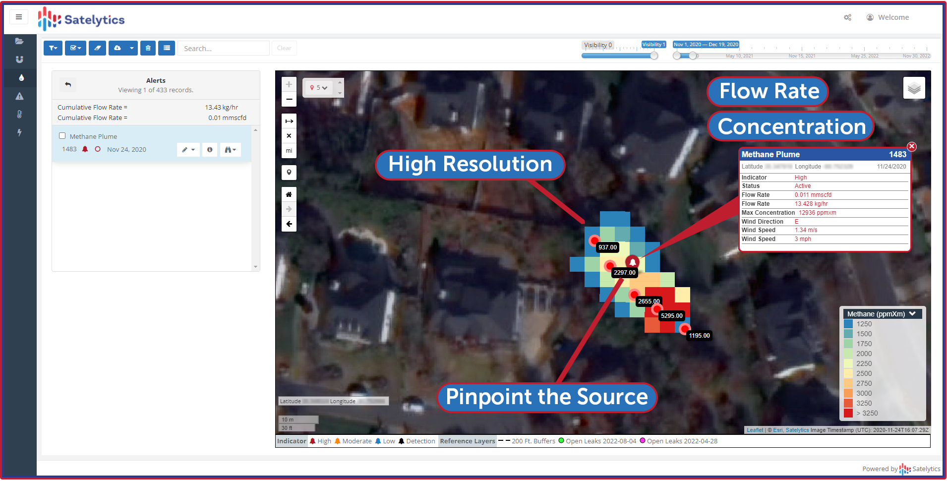
Fences, hedges, buildings no longer present obstacles to methane measurement.
We face similar challenges in the vegetation space for our electric utility clients. Risky trees might be hidden from view during routine surveys, but Satelytics’ utility vegetation algorithms identify the height, health, and type of every tree within and alongside the corridor. This empowers managers to take timely action. When gas and electric infrastructure overlap, we can tackle both challenges simultaneously for one cost.
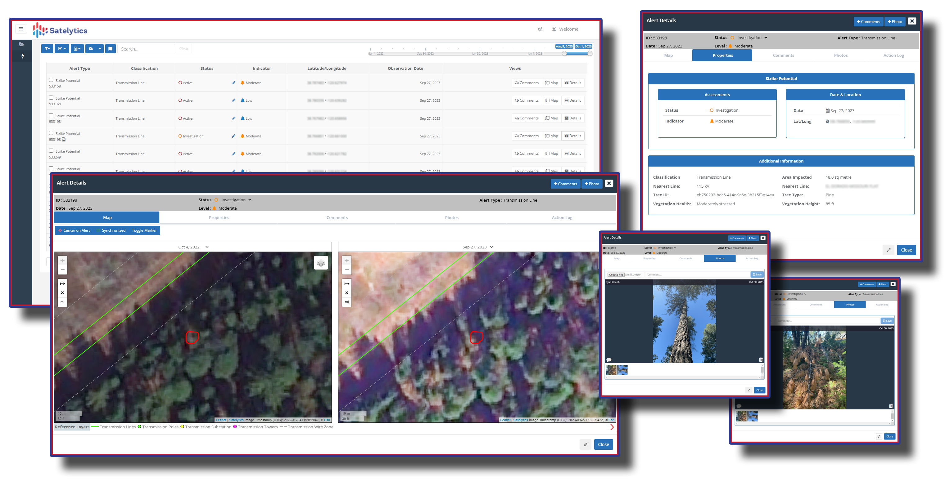
Example of utility vegetation results.
Ready to elevate your risk management with geospatial analytics? Let Satelytics transform your utility operations. Our advanced platform helps you detect gas leaks and assess vegetation risk with exceptional accuracy and efficiency. Don’t wait for the next inspection—act now to prevent potential threats. Contact us today for a demo and see how our innovative solutions can enhance your safety and compliance, maximizing your resources and peace of mind. With Satelytics, the sky isn't the limit—it's a vantage point.
We use cookies to analyze our web traffic and to enhance your experience. By continuing to view this website, you agree to our use of cookies.
Our Privacy Policy