• General
• General
Many in the “remote sensing” world claim to offer analytics but, in reality, are employing analysts to look at pictures and make inferences. Satelytics’ algorithms automatically analyze a satellite image, transforming it into actionable alerts and measurements within hours of image delivery.
Let’s take a closer look at what information is included in a Satelytics alert.
Once imagery is captured by the satellite, the resulting data is transmitted to the cloud, where Satelytics’ algorithms go to work immediately. Results are then deposited to the cloud for viewing a few hours after the satellite overpass. Results are published in the form of individual alerts. Each alert includes:
Alerts are presented in map form overlaid on the actual image or in a table format. The alert can also be displayed side-by-side with the previous analysis showing the change.
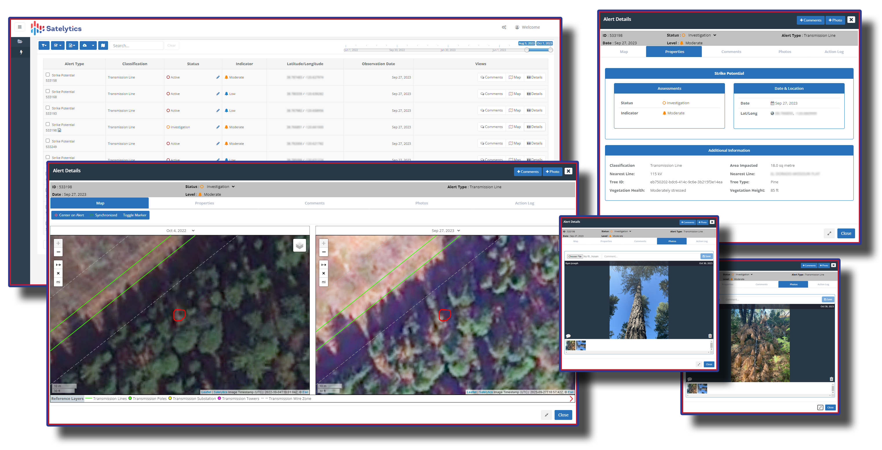
An example of a Satelytics data-rich alert.
Our mobile application, Satelytics OTG™, delivers all the same features as our online portal, viewable on a smartphone or tablet, even in areas lacking connectivity.
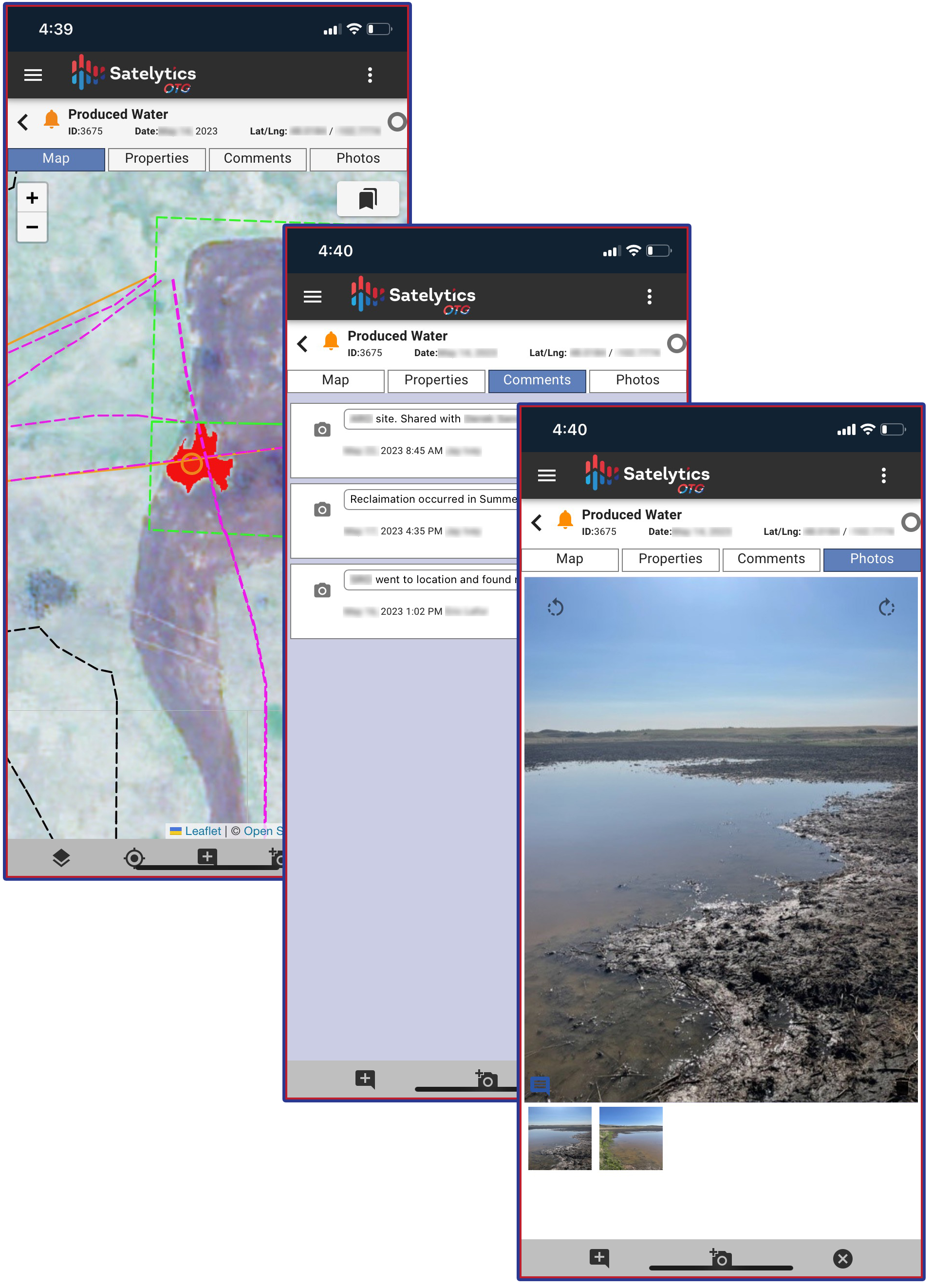
Alerts also mirrored in our mobile app, Satelytics OTG™.
Most of the above features are customizable to your company’s preference and are searchable by any parameter. Satelytics alerts deliver actionable results, enabling you to drive efficient field team response over your large asset areas.
Speak with a Satelytics representative today to discover how our geospatial analytics results can drive efficient action and lower costs for your company.
We use cookies to analyze our web traffic and to enhance your experience. By continuing to view this website, you agree to our use of cookies.
Our Privacy Policy