• General

• General
Tell them “WHERE it is, WHAT it is, and HOW BAD it is.”
This is our goal in producing actionable alerts for our customers. Our business model is designed to remove people from harm's way by replacing routine “foot patrol” monitoring with data gathered from satellite sensors. Raw imagery is analyzed very quickly to guide your experts only to the most immediate dangers. Regardless of the threat, Satelytics aims to not only detect it but also alert to its severity.
Where It Is
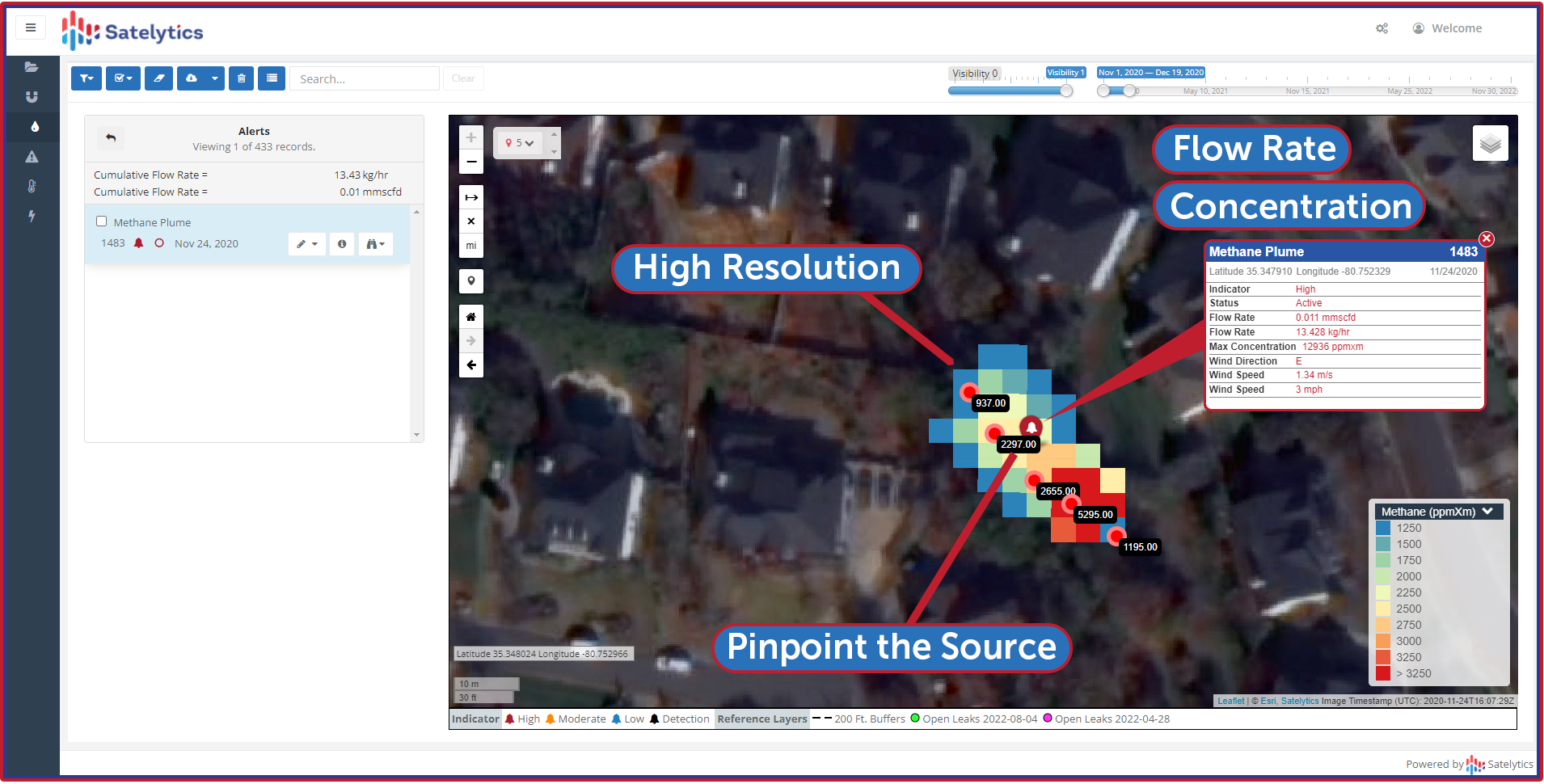
Satelytics’ Constant Vigilance algorithms identify threats in several ways. First, we precisely locate the threat. We analyze high-resolution imagery with spatial resolution of 30 to 50 centimeters (the size of a dinner plate), getting you very close to what is happening on the ground. Any object larger than the pixel size the sensor offers can be identified.

What It Is
The algorithms then label the threat using terminology preferred by the customer. Satelytics’ algorithms have been trained with field verification of alerts by our scientists and customers over the past 10+ years. Satelytics is not a group of analysts looking at satellite images — our AI algorithms scale up over very large asset areas identifying what the threat is: vehicles or geohazards in the right-of-way; construction of a pool or shed; digging activities; grasses, trees or brush; methane; liquid leaks; etc. can be identified with accuracy.
How Bad It Is (Quantification)
The final part of building an actionable alert is measuring how bad the threat is. Another term for this is quantification. Satelytics quantifies constituents like methane, chemicals in water or soil, land movement, etc., for our oil and gas and utility customers. Specific to vegetation, we measure tree height, health, and type. We also speciate invasive grasses and determine the extent of their proliferation in ranchlands. In watersheds, we can also measure nutrient load, turbidity, bathymetry, PFAS, and heavy metals.

Precise, quantified measurements.
In all instances, Satelytics offers the ability to adjust the threshold of the severity assessment based on your company’s unique monitoring program needs, thus reducing risk to personnel and assets.
Let Satelytics help you better understand where it is, what it is, and how bad it is. Ask us to demonstrate capabilities specific to your needs today.