• Oil & Gas,Pipeline
• Oil & Gas,Pipeline
In the vast expanse of oil fields and pipeline networks, how do you spot a needle in a haystack? Or better yet, how do you find multiple needles in multiple haystacks? This was the challenge facing a major oil & gas company operating in one of North America's premier basins.
Operating thousands of miles of pipelines and numerous well sites, one of our largest oil & gas customers faced a daunting task: maintaining operational efficiency while mitigating environmental risks. Traditional monitoring methods were falling short, leaving the company vulnerable to undetected threats, including leaks, gas emissions, encroachments, and surface disturbances. The potential consequences? Millions in lost product, clean-up costs, regulatory fines, and irreparable damage to their reputation.
Satelytics’ approach is summarized as follows: Don't just solve one problem – solve them all. By leveraging our comprehensive suite of geospatial analytics, we provided the customer with a truly multilateral solution. Here's how we transformed their operations:
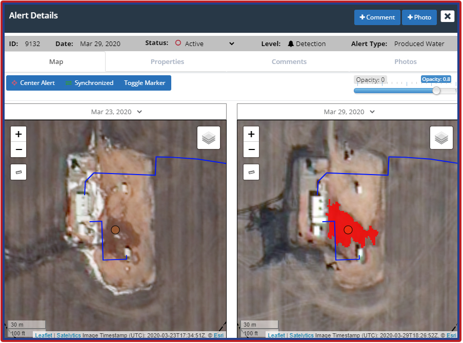
Produced water leak detected.
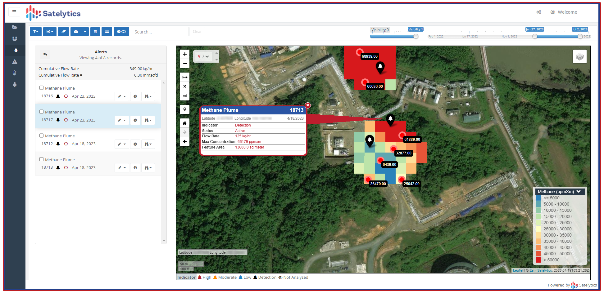
Coarse-resolution methane measurement (Global Methane™).
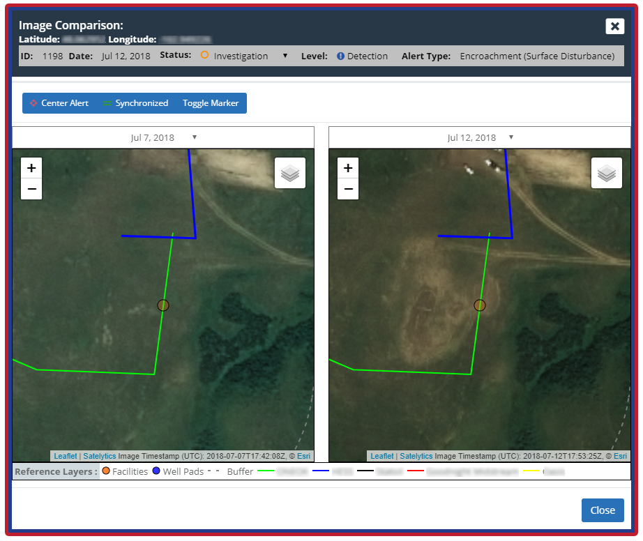
Surface disturbance may indicate a pending threat.
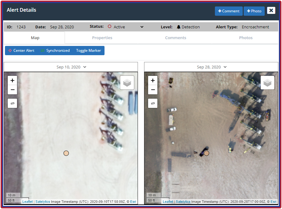
Vehicle encroachment -- this time not a threat, but some are.
The true magic of our solution lies in its integrated approach. By analyzing a single set of satellite data through multiple lenses (algorithms), we provide the customer with a comprehensive view of their operations. This not only maximizes the value of their investment but also reveals interconnected risks and opportunities that would have been missed by siloed solutions.
The results speak for themselves. Since implementing Satelytics' multilateral geospatial analytics in 2021, our customer has:
Employing single-purpose geospatial analytics is simply unwise. Success means extracting maximum actionable insights from each dataset. By embracing Satelytics' multilateral approach, our customer didn't just solve their initial challenge – they revolutionized their entire asset management strategy.
Ready to unlock the full potential of your operations? Contact Satelytics today and discover how our multilateral geospatial analytics can transform your business. Don't just solve one problem – solve them all.
We use cookies to analyze our web traffic and to enhance your experience. By continuing to view this website, you agree to our use of cookies.
Our Privacy Policy