• General
• General
In the high-stakes world of infrastructure protection, are you relying on a single line of defense? If so, you might leave your assets more vulnerable than you think.
When protecting critical infrastructure, many organizations focus on a single solution – be it traditional inspections, ground-based sensors, or basic satellite imagery. But what if we told you this approach is like building a castle with just one wall?
Enter the concept of Defense in Depth – a comprehensive strategy that employs multiple layers of security to protect your systems and data. This military-inspired approach doesn't just address a single vulnerability; it creates a robust fortress of protection that can withstand multi-layered threats.
At Satelytics, we believe that satellite-based geospatial analytics should be the cornerstone of your Defense in Depth strategy. Here's why:
Let's look at how Defense in Depth works in practice.
Methane Measurement Over a Gas Distribution Network
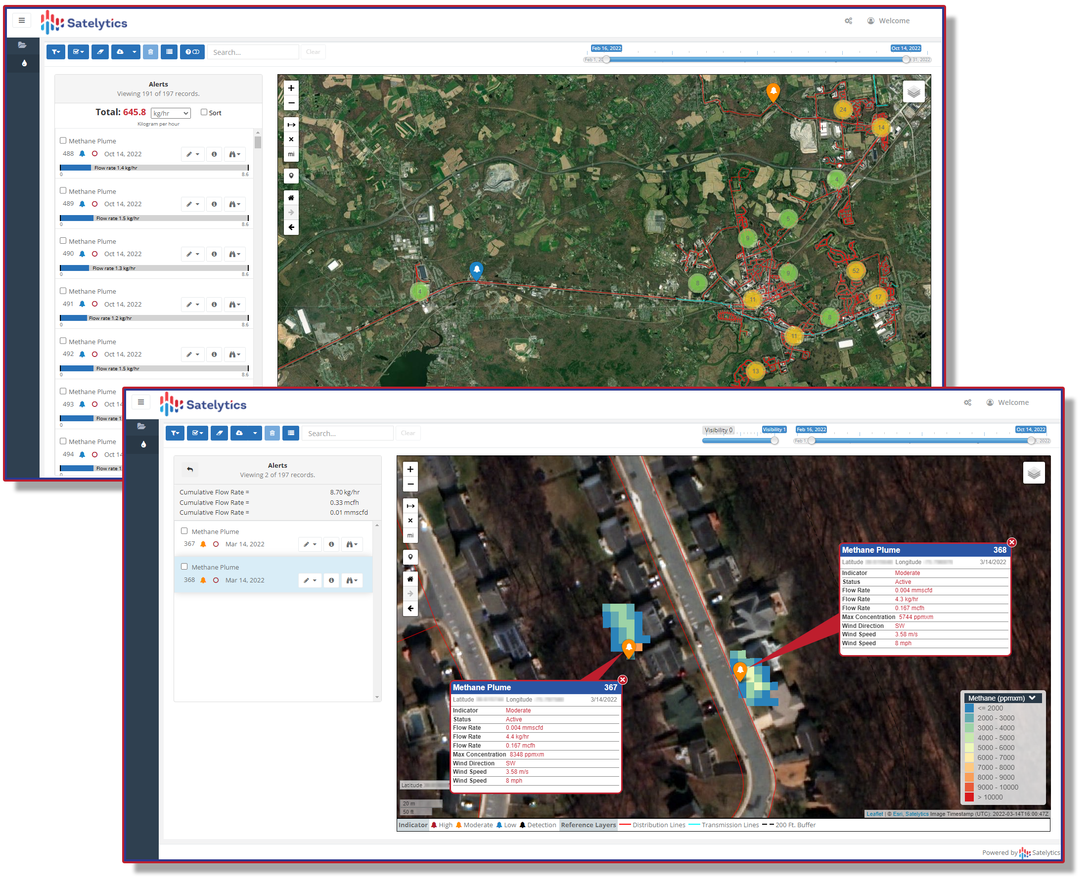
Methane measurement.
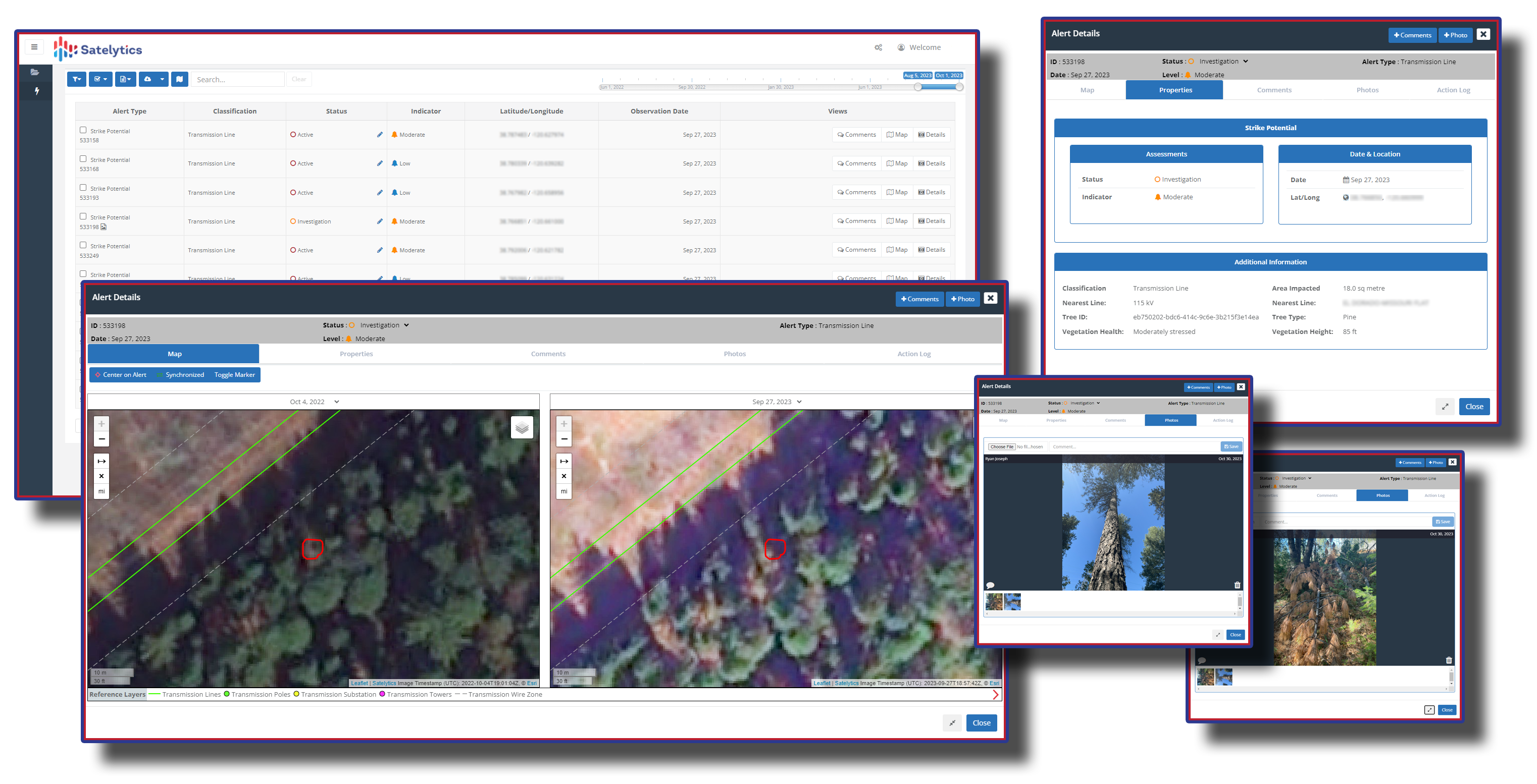
Utility vegetation management.
Liquid Pipeline Leak Detection
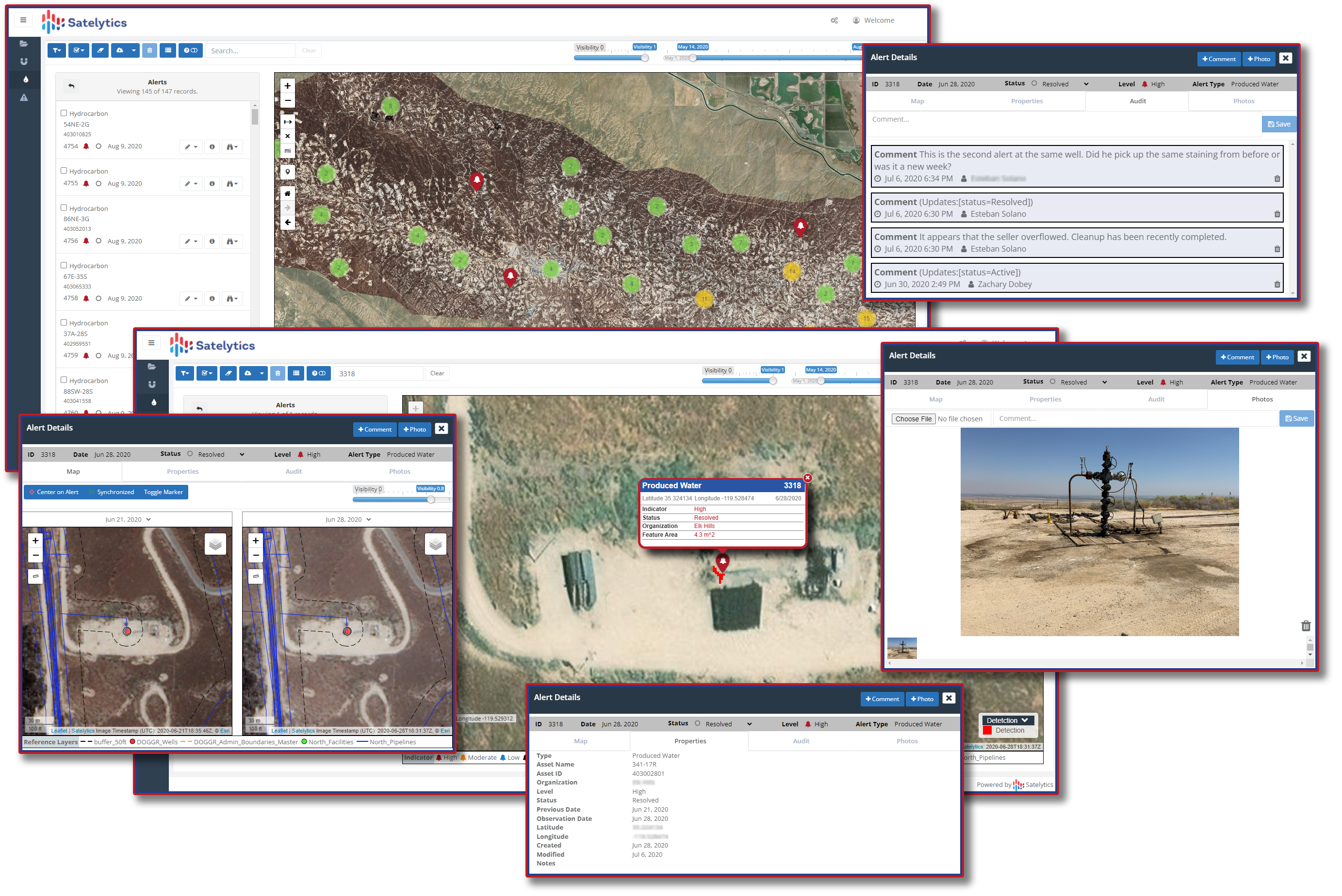
Produced water leak detection.
While no single solution can cover every possible scenario, Satelytics' ability to address 90% of threats quickly and efficiently is a game-changer. This leaves only a small percentage of your assets requiring more time-intensive, ground-based methods.
Wouldn't it be nice to know confidently that you've covered 90% of your assets quickly with automated, actionable alerts, reducing the number of sites at which you need to employ slower, more tedious methods?
In today's complex threat landscape, a single-layer defense is simply not enough. By incorporating Satelytics' advanced geospatial analytics into your Defense in Depth strategy, you're not just protecting your infrastructure – you're fortifying it against the unknown.
Ready to add a powerful layer to your defense strategy? Contact Satelytics today and discover how our bird's-eye view can be your infrastructure's best line of defense.
We use cookies to analyze our web traffic and to enhance your experience. By continuing to view this website, you agree to our use of cookies.
Our Privacy Policy