• General
• General
Satellite imagery is not necessarily a new development. However, the spatial resolution and wavelength bands offered by modern satellites have rapidly propelled the advancement of geospatial monitoring programs. Over just the past decade, an entire industry has emerged around leveraging AI analytics to process satellite data streams. What once seemed unimaginable — remotely monitoring vast asset areas spanning thousands of square miles — is now a reality with Satelytics.
But how do you begin building a geospatial analytics program? Here’s a concise, three-step guide we use to help clients integrate this innovative data stream into their asset management systems with a cost-effective Proof of Concept (POC) project:
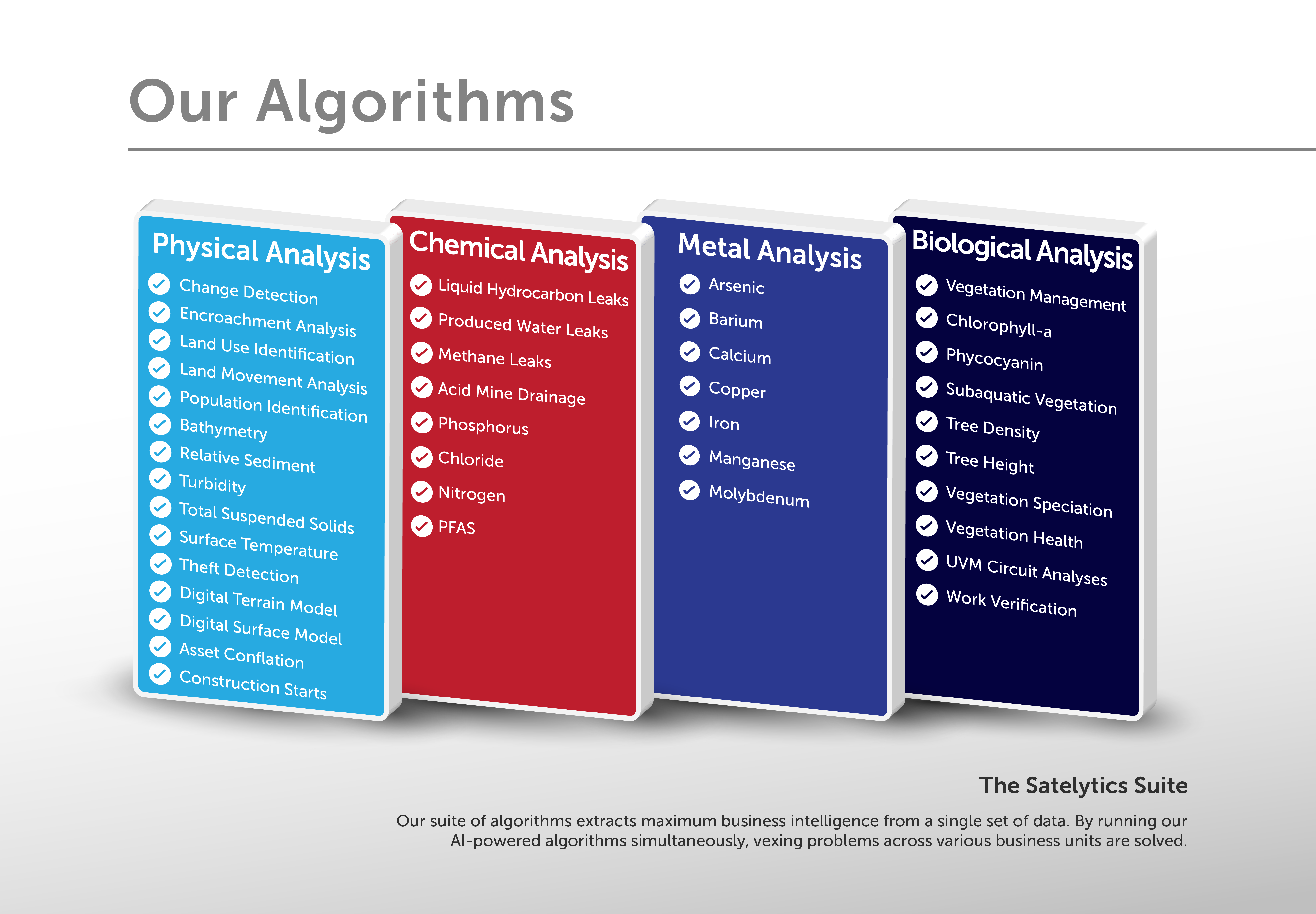
Start by identifying the primary challenges you aim to solve. Satelytics offers cutting-edge algorithms that can detect and quantify common threats to large energy delivery systems, such as encroachments, geohazards, vegetation, liquid leaks, methane, and more. While every project begins by tackling a primary challenge, our technology allows secondary and tertiary threats to be seamlessly added without additional cost.
Establish how frequently data needs to be collected to mitigate risk effectively. Satellite imagery is now available from a wide selection of commercial vendors, and Satelytics' algorithms are already trained to process data from many of them. The ideal frequency usually depends on regulatory requirements and the client’s understanding of their risk profile, and we can meet even the most demanding revisit schedules.
While satellites cover vast territories and our AI algorithms scale effortlessly thanks to cloud computing, starting with a smaller, focused area is crucial for success. Select a region with known challenges to validate the utility of geospatial analytics during your POC project. Include several key analyses to measure KPIs and refine your response processes. This foundational approach ensures operational readiness when expanding to larger-scale projects.
Take the first step toward revolutionizing your asset management strategy by launching a Satelytics POC project today. Start small, think big, and prepare to transform how you monitor and protect your valuable infrastructure.
We use cookies to analyze our web traffic and to enhance your experience. By continuing to view this website, you agree to our use of cookies.
Our Privacy Policy